Shire of Strathbogie
|
Shire of Strathbogie Victoria |
|||||||||||||
|---|---|---|---|---|---|---|---|---|---|---|---|---|---|

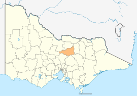
Location in Victoria
|
|||||||||||||

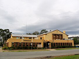
Council Offices in Euroa
|
|||||||||||||
| Population | 9,826 (2015 est) | ||||||||||||
| • Density | 2.9758/km2 (7.7072/sq mi) | ||||||||||||
| Established | 1994 | ||||||||||||
| Gazetted | 18 November 1994 | ||||||||||||
| Area | 3,302 km2 (1,274.9 sq mi) | ||||||||||||
| Mayor | Cr Debra Swan | ||||||||||||
| Council seat | Euroa | ||||||||||||
| Region | Hume | ||||||||||||
| State electorate(s) | Euroa | ||||||||||||
| Federal Division(s) | Murray | ||||||||||||
 |
|||||||||||||
| Website | Shire of Strathbogie | ||||||||||||
|
|||||||||||||
The Shire of Strathbogie is a local government area in the Hume region of Victoria, Australia, located in the north-east part of the state. It covers an area of 3,302 square kilometres (1,275 sq mi) and, at the 2011 Census, had a population of 9,486. It includes the towns of Avenel, Euroa, Longwood, Nagambie, Strathbogie and Violet Town. It was formed in 1994 from the amalgamation of parts of the Shire of Euroa, Shire of Goulburn, Shire of Violet Town, Shire of McIvor and Rural City of Seymour.
The Shire is governed and administered by the Strathbogie Shire Council; its seat of local government and administrative centre is located at the council headquarters in Euroa, it also has service centres located in Nagambie and Violet Town. The Shire is named after the major geographical feature in the region, the Strathbogie Ranges, which is located in the south-east of the LGA.
The Shire is about 150 kilometres (90 mi) from Melbourne and bordered to the east by the Strathbogie Ranges and to the west by the Nagambie Lakes district. It is also known for its sheep production, horse studs (earning the title "The Horse Capital of Victoria"), wineries (Mitchelton, Tahbilk, Plunkett's), olives and alpacas. Tourism is a growing industry in the area, with many B&Bs, hotels and restaurants.
...
Wikipedia
