Strathbogie Ranges
| Strathbogie Ranges | |
|---|---|
| Strathbogie Tableland | |
|
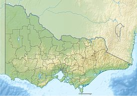
Location of the Strathbogie Ranges in Victoria
|
|
| Dimensions | |
| Length | 50 km (31 mi) N-S |
| Width | 10 km (6.2 mi) E-W |
| Geography | |
| Country | Australia |
| State/Province | Victoria |
| Range coordinates | 36°50′49″S 145°23′13″E / 36.847°S 145.387°ECoordinates: 36°50′49″S 145°23′13″E / 36.847°S 145.387°E |
| Parent range | Great Dividing Range |
| Geology | |
| Age of rock | Devonian |
| Type of rock | Strathbogie Granodiorite |
The Strathbogie Ranges are a set of low mountain ranges within the Great Dividing Range, rising to 1,033 metres (3,389 ft) at Mount Strathbogie. The Strathbogie Ranges are located approximately 150 kilometres (93 mi) north-east of Melbourne, Victoria.
The range is the remains of a granite uplifted plateau in the southern part of the ranges and volcanic eruption in the north which formed a 20–30-kilometre (12–19 mi) wide cauldron volcano. The topography consists of a series of ridges dissected by streams. The Strathbogie Ranges are north of the main Great Dividing Range, separated by the Goulburn and Broken River valleys. This separation has produced unique biogeographic and ecological patterns. Some of the more prominent peaks of the range include Mount Strathbogie (1,033 metres (3,389 ft)), Mount Wombat (791 metres (2,595 ft)), Sugarloaf (691 metres (2,267 ft)) and Mount Barranhet (832 metres (2,730 ft)).
The Strathbogie Ranges are located near the boundary between the Wurundjeri and Taungurong nations territories. The two nations were part of the Kulin alliance and were most often on friendly terms. The mountain range however was not often frequented by either nations people as mountainous areas were often considered one of many resting places for various spirits.
Squatters running sheep and hundreds of cattle took up large tracts of land in the Ranges from about 1842. The stations included Bailey Hill, Strathbogie, Springs A and Wombat Hill, predominantly in the hill country, while parts of Saintfield and Borodomanin were also in the ranges. John Gall of Wombat Hill was one of the few elary settlers to remain in the district. John Kissock of Strathbogie Station arrived in the 1847, while William Forlonge later owned Strathbogie totalling 185,000 acres (75,000 ha), and many of the other pastoral stations, between the early 1850s and 1867.
In 1891 a butter factory was built at Strathbogie South (as Strathbogie was then known and a second factory was built in 1892 at Strathbogie North. A Post Office opened in Strathbogie on 10 July 1878.
There are several districts located within the Strathbogie Ranges including Strathbogie, Ruffy, and Highlands, but no towns and few major roads; Strathbogie township has a general store and Ruffy township has 'The Pantry'.
...
Wikipedia

