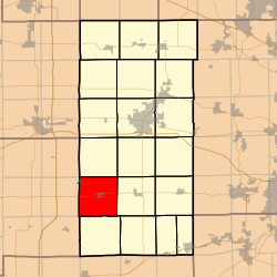
Shabbona Township, DeKalb County, Illinois
| Shabbona Township | |
|---|---|
| Township | |
 Location in DeKalb County |
|
 DeKalb County's location in Illinois |
|
| Coordinates: 41°45′37″N 88°53′04″W / 41.76028°N 88.88444°WCoordinates: 41°45′37″N 88°53′04″W / 41.76028°N 88.88444°W | |
| Country |
|
| State |
|
| County | DeKalb |
| Established | November 6, 1849 |
| Area | |
| • Total | 35.18 sq mi (91.1 km2) |
| • Land | 34.59 sq mi (89.6 km2) |
| • Water | 0.59 sq mi (1.5 km2) 1.68% |
| Elevation | 889 ft (271 m) |
| Population (2010) | |
| • Estimate (2016) | 1,445 |
| • Density | 42/sq mi (16/km2) |
| Time zone | CST (UTC-6) |
| • Summer (DST) | CDT (UTC-5) |
| ZIP codes | 60518, 60530, 60550, 60556 |
| FIPS code | 17-037-68835 |
Shabbona Township is one of nineteen townships in DeKalb County, Illinois, USA. As of the 2010 census, its population was 1,453 and it contained 603 housing units. The township contains the Chief Shabbona Forest Preserve and Shabbona Lake State Park.
According to the 2010 census, the township has a total area of 35.18 square miles (91.1 km2), of which 34.59 square miles (89.6 km2) (or 98.32%) is land and 0.59 square miles (1.5 km2) (or 1.68%) is water. The township is named after the Potawatomi tribal leader, Chief Shabbona.
(This list is based on USGS data and may include former settlements.)
The township contains these four cemeteries: Old English, Smith, Lee Calvary and Rose Hill.
...
Wikipedia
