Seymour, Victoria
|
Seymour Victoria |
|||||||||||||
|---|---|---|---|---|---|---|---|---|---|---|---|---|---|

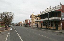
Station Street, with the Terminus and Railway Club hotels in the foreground
|
|||||||||||||
| Coordinates | 37°1′48″S 145°7′48″E / 37.03000°S 145.13000°ECoordinates: 37°1′48″S 145°7′48″E / 37.03000°S 145.13000°E | ||||||||||||
| Population | 6,360 (2011 census) | ||||||||||||
| Established | 1839 | ||||||||||||
| Postcode(s) | 3660 | ||||||||||||
| Elevation | 148 m (486 ft) | ||||||||||||
| Location |
|
||||||||||||
| LGA(s) | Shire of Mitchell | ||||||||||||
| State electorate(s) | Euroa | ||||||||||||
| Federal Division(s) | McEwen | ||||||||||||
|
|||||||||||||
|
|||||||||||||
Seymour (/ˈsiːmɔːr/, locally [ˈsiːmoː]) is a township in Mitchell Shire in the state of Victoria, Australia and is located 104 kilometres (65 mi) north of Melbourne. At the 2011 census, Seymour had a population of 6,360. The township services the surrounding agricultural industries (primarily equine, cattle, sheep and wine) as well as the nearby military base of Puckapunyal (population 1,176), which is an important training centre for the Australian Army. Other important sectors of employment in Seymour include retail, light engineering, agricultural services support, medical services, and education.
The Taungurung (Daung wurrung) people are the traditional owners and inhabitants of the area Seymour now occupies. Specifically it is the land of the Buthera Balug clan who occupied the area when Europeans first settled the region in the early 1800s. In 1824, Hume and Hovell on their return from Port Phillip, camped by the Goulburn River not far upstream of Seymour. In 1836 Major Mitchell crossed the Goulburn at Mitchellstown and soon afterwards overlanders and other early settlers began to use this crossing place on the Melbourne-Sydney route (now known as the Hume Highway). The mail service between Melbourne and Sydney had been operating for just a year when it was found that a better route was available using the "New Crossing Place".
...
Wikipedia

