Seven Ranges Terminus
|
Seven Ranges Terminus
|
|

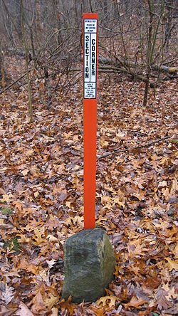
The marker with a modern surveying marker
|
|
| Nearest city | Magnolia, Ohio |
|---|---|
| Coordinates | 40°39′7″N 81°19′5″W / 40.65194°N 81.31806°WCoordinates: 40°39′7″N 81°19′5″W / 40.65194°N 81.31806°W |
| Built | August 10, 1786 |
| NRHP Reference # | 76001527 |
| Added to NRHP | December 12, 1976 |
Seven Ranges Terminus is a stone surveying marker near Magnolia, Ohio that marks the completion of the first step in opening the lands northwest of the Ohio River to sale and settlement by Americans. This survey marked the first application of the rectangular plan for subdividing land.
With victory in the Revolutionary War, the Treaty of Paris granted the United States lands north of the Ohio River, south of the Great Lakes, and east of the Mississippi River, called the Northwest Territory. The US Congress adopted the Land Ordinance of 1785 as a method for surveying, selling and settling these lands. This ordinance established a method for surveying the land into a grid of six mile square survey townships. These townships were to be arranged into vertical rows called “Ranges”. The first ranges were to be measured from a meridian along the western boundary of Pennsylvania. The townships in each range were measured from an east-west line called a baseline. This became the genesis of the techniques used in the Public Land Survey System.
The 1785 ordinance called for the Geographer of the United States, Thomas Hutchins, to personally supervise the first survey. It called for Hutchins to establish a Point of Beginning on the north bank of the Ohio River where it leaves Pennsylvania. From there he was to establish a baseline seven ranges wide, (42 miles), called the “Geographer’s Line”, and then survey north-south lines each six miles to mark the edges of the ranges, and then establish the south boundary of each township. After each seven ranges had been completed, the Geographer was to return plats to the federal government for marketing and sale.
...
Wikipedia


