Serra Malagueta
| Serra da Malagueta | |
|---|---|

Serra da Malagueta
|
|
| Highest point | |
| Elevation | 1,064 m (3,491 ft) |
| Prominence | 2nd in Santiago |
| Listing | List of mountains in Cape Verde |
| Coordinates | 15°10′46″N 23°40′20″W / 15.17944°N 23.67222°WCoordinates: 15°10′46″N 23°40′20″W / 15.17944°N 23.67222°W |
| Geography | |
|
northern Santiago
|
|
| Geology | |
| Age of rock | Miocene and Pliocene |
| Mountain type | Stratovolcano |
| Type of rock | basalt, basanite |
| Climbing | |
| Easiest route | climb |
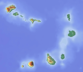
Serra da Malagueta is a mountain located in the northern part of the island of Santiago, Cape Verde. At 1064 m elevation, it is the second highest peak of Santiago island, after Pico da Antónia (1394 m), also that mountain is separated by 15.7 km. The mountain and its ranges forms a part of Serra da Malagueta Natural Park (Eco Serra Malagueta or Parco Natural de Serra da Malagueta), established on February 24, 2005 and covers 774 hectares. It is situated on the border of the municipalities Tarrafal, São Miguel and Santa Catarina. The mountain range dominates the north of the island stretching from Poilão in Santa Cruz up to the vicinity of Tarrafal. Its name etymology is from a plant (Capsicum), a variety of pepper, the "Malagueta pepper". It also gives its name to a nearby settlement in the westcentral portions named Serra da Malagueta or Serra Malagueta, it is also known by its short form of Serra.
The mountain area forms a source of several streams including Ribeira Principal (the main stream) and a few nearby springs. Other sources of other streams include Ribeira de Cuba and Ribeira de São Miguel.
During the Ice Age from around 15000 to 10000 BC, the elevation was under 1,200 meters, up to about 5000 BC, the elevation was over 1,100 meters.
The mountain range was best known for the communities with Rabelados movement. The largest of which lives in the settlement of Espinho Branco located northwest of Calheta de São Miguel.
In 1983, the route between Assomada and Tarrafal opened crossing through the middle of Serra Malagueta and bypassing Figueira das Naus and Ribeira da Prata and its dangerous curves by the Atlantic in the range's west. Construction started somewhere at the end of the 1970s.
...
Wikipedia

