Sepphoris
|
Tzippori צִפּוֹרִי |
|
|---|---|
 |
|
| Coordinates: 32°44′44″N 35°16′43″E / 32.74556°N 35.27861°ECoordinates: 32°44′44″N 35°16′43″E / 32.74556°N 35.27861°E | |
| District | Northern |
| Council | Jezreel Valley |
| Affiliation | Moshavim Movement |
| Founded | 1949 |
| Population (2015) | 952 |
| Saffuriyya | |
|---|---|

Sefurieh, 1859
|
|
| Arabic | صفورية |
| Also spelled | Suffurriye, Safurriya |
| Subdistrict | Nazareth |
| Palestine grid | 176/239 |
| Population | 4,330 (1945) |
| Area | 55,378 dunams |
| Date of depopulation | 16 July 1948/January 1949 |
| Cause(s) of depopulation | Military assault by Yishuv forces |
| Secondary cause | Expulsion by Yishuv forces |
| Current localities | Zippori and the village land was distributed between Kibbutz Sde Nahum, Kibbutz Heftziba and Kibbutz HaSolelim |
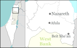
Sepphoris /sᵻˈfɔːrᵻs/ or Zippori /ˈzɪpəraɪ/ (Ancient Greek: Σέπφωρις Sépphōris; Hebrew: צִפּוֹרִי Tzipori; Arabic: صفورية Saffuriya), also called Diocaesaraea (Ancient Greek: Διοκαισάρεια) and, during the Crusades, Sephory/ˈsɛfəri/ (Old French: La Sephorie), is a village and an archeological site located in the central Galilee region of Israel, 6 kilometers (3.7 mi) north-northwest of Nazareth. It lies 286 m above sea level and overlooks the Beit Netofa Valley. The site holds a rich and diverse historical and architectural legacy that includes Hellenistic, Jewish, Roman, Byzantine, Islamic, Crusader, Arabic and Ottoman influences. In Late Antiquity, it was believed to be the birthplace of Mary, mother of Jesus, and the village where Saints Anna and Joachim are often said to have resided.
...
Wikipedia

