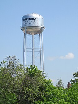
Senatobia, MS
| Senatobia, Mississippi | |
|---|---|
 |
|
| Motto: The Five Star City | |
 Location of Senatobia, Mississippi |
|
| Location in the United States | |
| Coordinates: 34°36′59″N 89°58′10″W / 34.61639°N 89.96944°WCoordinates: 34°36′59″N 89°58′10″W / 34.61639°N 89.96944°W | |
| Country | United States |
| State | Mississippi |
| County | Tate |
| Chartered | 1860 |
| Government | |
| • Mayor | Alan Callicot |
| Area | |
| • Total | 10.8 sq mi (27.9 km2) |
| • Land | 10.7 sq mi (27.8 km2) |
| • Water | 0.0 sq mi (0.1 km2) |
| Elevation | 289 ft (88 m) |
| Population (2010) | |
| • Total | 8,165 |
| • Density | 621.7/sq mi (240.0/km2) |
| Time zone | Central (CST) (UTC-6) |
| • Summer (DST) | CDT (UTC-5) |
| ZIP code | 38668 |
| Area code(s) | 662 Exchanges: 301,560,562 |
| FIPS code | 28-66440 |
| GNIS feature ID | 0677513 |
| Highways |
|
| Website | http://www.cityofsenatobia.com |
Senatobia is a city in and the county seat of Tate County, Mississippi, and is the 16th largest municipality in the Memphis Metropolitan Area. The population was 8,165 at the 2010 census.
Senatobia is the home of Northwest Mississippi Community College, a state community college that provides two-year academic and technical degree programs. Northwest's system-wide enrollment exceeds 8,000 on three campuses in Senatobia, Southaven and Oxford. Also located in Senatobia is the Baddour Center, a residential care facility for intellectually disabled adults.
On April 13, 1834 early settler James Peters purchased two sections of land from the Chickasaw Nation for the sum of $1.25 per acre. This land was later developed as the town of Senatobia. The name Senatobia, given by Charles Meriweather, was derived from the Indian word Senatohoba, which means “White Sycamore”—a symbol of "rest for the weary."
Senatobia received its charter as a municipality in 1860. Tate County was organized in 1873, during the Reconstruction era. During the Civil War, the town's business section was burned twice by Federal troops.
Two Academy Award-nominated films have been partially filmed in the town: The Client (1994) and The People vs. Larry Flynt (1996).
According to the United States Census Bureau, the city has a total area of 10.8 square miles (28 km2), of which 10.8 square miles (28 km2) is land and 0.04 square miles (0.10 km2) (0.28%) is water.
As of the census of 2010, there were 8,165 people, 2,554 households, and 1,826 families residing in the city, up from 6,682 people, 2,137 households, and 1,498 families recorded in the census of 2000. The population density was 621.7 people per square mile (240.0/km²). There were 2,239 housing units at an average density of 208.3 per square mile (80.4/km²). The racial makeup of the city was 61.1% non-Hispanic White, 35.0% non-Hispanic African American, 2.4% Hispanic or Latino of any race, and 1.6% in other racial/ethnic categories. In the 2000 census, the distribution had been 68.03% White, 30.51% African American, 0.12% Native American, 0.22% Asian, 0.15% Pacific Islander, 0.24% from other races, and 0.72% from two or more races, while Hispanic or Latino of any race were 0.85% of the population.
...
Wikipedia

