Segesvár
| Sighișoara | ||
|---|---|---|
| City | ||
 |
||
|
||
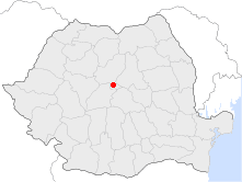
 Location of Sighișoara |
||
| Coordinates: 46°13′1″N 24°47′28″E / 46.21694°N 24.79111°ECoordinates: 46°13′1″N 24°47′28″E / 46.21694°N 24.79111°E | ||
| Country |
|
|
| County | Mureș County | |
| Status | Municipality | |
| Government | ||
| • Mayor | Ovidiu Mălăncrăvean (Social Democratic Party) | |
| Population (2011) | ||
| • Total | 28,102 | |
| Time zone | EET (UTC+2) | |
| • Summer (DST) | EEST (UTC+3) | |
| Website | http://www.sighisoara.org.ro/ | |
Sighișoara (Romanian pronunciation: [siɡiˈʃo̯ara]; German: Schäßburg, pronounced [ˈʃɛsbʊɐ̯k]; Hungarian: Segesvár, pronounced [ˈʃɛɡɛʃvaːr]; Latin: Castrum Sex) is a city on the Târnava Mare River in Mureș County, Romania. Located in the historic region of Transylvania, Sighișoara has a population of 28,102 according to the 2011 census.
The city administers seven villages: Angofa, Aurel Vlaicu, Hetiur, Rora, Șoromiclea, Venchi and Viilor.
During the 12th century, German craftsmen and merchants known as the Transylvanian Saxons were invited to Transylvania by the King of Hungary to settle and defend the frontier of his realm. The chronicler Krauss lists a Saxon settlement in present-day Sighișoara by 1191. A document of 1280 records a town built on the site of a Roman fort as Castrum Sex or "six-sided camp", referring to the fort's shape of an irregular hexagon. Other names recorded include Schaäsburg (1282), Schespurg (1298) and Segusvar (1300). By 1337 Sighișoara had become a royal center for the kings, who awarded the settlement urban status in 1367 as the Civitas de Segusvar.
...
Wikipedia

