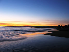
Seacliff State Beach
| Seacliff State Beach | |
|---|---|
 |
|
| Location | Aptos, California |
| Coordinates | 36°58′20″N 121°54′50″W / 36.97222°N 121.91389°WCoordinates: 36°58′20″N 121°54′50″W / 36.97222°N 121.91389°W |
| Established | 1931 |
| Governing body | California Department of Parks and Recreation |
| http://www.parks.ca.gov/default.asp?page_id=543 | |
Seacliff is a California State Beach located off Highway 1 in the town of Aptos about 5 miles (8 km) south of Santa Cruz, on State Park Drive. The beach is most known for the concrete ship SS Palo Alto lying in the water. North of Seacliff State Beach is New Brighton State Beach.
The beach was originally home to the Ohlone people. Spanish missionaries established the Mission Santa Cruz about eight miles west of here. In 1821, when Mexico broke away from Spain the land was divided up into land grants. The area of the beach was a part of the Rancho Aptos grant to Rafael Castro in 1833. Castro worked with Claus Spreckels to establish the Castro-Spreckels wharf. The beach soon became a successful shipping port. The logging industry also thrived here with the local redwood trees.
The port facilitated major trade with the Kingdom of Hawaiʻi. In 1838, King Kamehameha III requested that Mexican vaqueros from California travel to Hawaiʻi to teach Hawaiians how to manage herds of wild cattle. Seacliff became a popular place to recruit vaqueros, who were known as paniolos by the Hawaiians.
In the 1850s, Thomas Fallon acquired part of the beach and turned it into a resort. He named this new resort "New Brighton", in honor of his favorite seaside resort in England.
In the 1920s, after Claus Spreckels' death, sections of the beach were developed into the Seacliff Park and the Rio Del Mar Country Club.
...
Wikipedia


