Schweizerland
| Schweizerland | |
|---|---|
| Schweizerland Alps | |

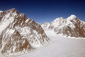
View of the mountains rising above the Midgard Glacier at the southern end of the range.
|
|
| Highest point | |
| Peak | Mont Forel |
| Elevation | 3,383 m (11,099 ft) |
| Dimensions | |
| Length | 75 km (47 mi) N/S |
| Width | 40 km (25 mi) E/W |
| Area | 270 km² |
| Geography | |
| Country | Greenland |
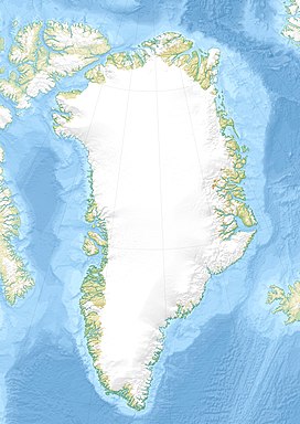
| Range coordinates | 66°40′N 37°0′W / 66.667°N 37.000°WCoordinates: 66°40′N 37°0′W / 66.667°N 37.000°W |
Schweizerland, also known as Schweizerland Alps, is a mountain range in King Christian IX Land, eastern Greenland. Administratively this range is part of the Sermersooq Municipality. Its highest point is one of the highest peaks in Greenland.
Schweizerland is located a popular climbing destination, together with the Watkins Range to the northeast and the Stauning Alps further north.Tasiilaq Heliport is located near the area of the range.
The range was formerly a remote unknown area. It was named 'Schweizerland' in 1912 by Swiss geophysicist and Arctic explorer Alfred De Quervain following his Greenland ice cap crossing from Godhavn (Qeqertarsuaq) on the west, to Sermilik Fjord on the eastern side.
De Quervain also identified the position and approximate height of Mont Forel, highest point of Schweizerland. Mont Forel was then thought to be the highest mountain in the Arctic Circle area. However, at the time of the British Arctic Air Route Expedition led by Gino Watkins in 1930, Watkins discovered a new mountain range from the air located over 350 km to the northeast. This was the higher Watkins Range with the Gunnbjørnsfjeld, the actual highest summit in Greenland. An attempt to climb Mont Forel was made by Lawrence Wager and Alfred Stephenson in 1931 but the mountaineers were stopped by the ice dome at the top of the mountain.
In the years that followed, Watkins' 1932-33 East Greenland Expedition, the 1934 British Trans-Greenland Expedition with Lindsay, Croft and Lieutenant Arthur Godfrey of the Royal Engineers —which mapped the much larger Crown Prince Frederick Range to the northeast, and the 1936-37 P.E. Victor Expedition visited Schweizerland. All these expeditions carried out surveys in the little-known mountainous region, the latter taking a great number of photographs and sketches. Mont Forel would be finally climbed in the same decade by an expedition of the Akademischer Alpen-Club of Zürich led by André Roch in 1938.
...
Wikipedia

