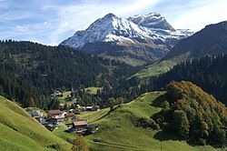
Schröcken
| Schröcken | ||
|---|---|---|
 |
||
|
||
| Location within Austria | ||
| Coordinates: 47°15′00″N 10°05′00″E / 47.25000°N 10.08333°ECoordinates: 47°15′00″N 10°05′00″E / 47.25000°N 10.08333°E | ||
| Country | Austria | |
| State | Vorarlberg | |
| District | Bregenz | |
| Government | ||
| • Mayor | Herbert Schwarzmann | |
| Area | ||
| • Total | 23.43 km2 (9.05 sq mi) | |
| Elevation | 1,269 m (4,163 ft) | |
| Population (1 January 2016) | ||
| • Total | 214 | |
| • Density | 9.1/km2 (24/sq mi) | |
| Time zone | CET (UTC+1) | |
| • Summer (DST) | CEST (UTC+2) | |
| Postal code | 6888 | |
| Area code | 05519 | |
| Vehicle registration | B | |
| Website | www.warth-schroecken.com | |
Schröcken is a municipality in the district of Bregenz in the Austrian state of Vorarlberg.
Schröcken is located in the western province of Austria, Vorarlberg, Bregenz in the district south-south-east of the Bodensee. It is in the Austrian Alps and is at an altitude of 1,269 meters. 12.4% of the area are forested, 39.4% of the Alpine area.
The area around Schröcken was first populated around 1300 by German-speaking people known as the Walser, who came to Austria in from the Bernese Oberland highlands located in the southern part of the Canton of Bern, Switzerland. The town was made part of a regional administrative area called Tannberg in 1806.
The town is located near the border between Switzerland, Austria, and Germany. From 1805 to 1814, the town was under the jurisdiction of the Free State of Bavaria. The town was also part of the Austro-Hungarian Habsburg Empire, and later to the administrative zone of Vorarlberg, Austria. From 1945 to 1955, Schröcken was part of the French occupation zone in Austria.
The original name was "Girsboden". "Schröcken" first appeared in the early 17th century.
The political administrative body consists of a 9-member council and a Mayor, and belongs to the political district of Bregenz.
Church of Our Lady Assumption The first church of Schröcken was built in 1639. The church increased its membership from 1726 to 1732, but the building was destroyed by fire in 1863. A rebuilding effort took place between 1864 and 1867 and the church was re-consecrated. The Church is surrounded by a walled cemetery
...
Wikipedia


