Schlieren, Switzerland
| Schlieren | ||
|---|---|---|
 |
||
|
||
| Coordinates: 47°24′N 8°27′E / 47.400°N 8.450°ECoordinates: 47°24′N 8°27′E / 47.400°N 8.450°E | ||
| Country | Switzerland | |
| Canton | Zurich | |
| District | Dietikon | |
| Government | ||
| • Executive |
Stadtrat with 7 members |
|
| • Mayor |
Stadtpräsident Toni Brühlmann (as of March 2014) |
|
| • Parliament |
Gemeindeparlament with 36 members |
|
| Area | ||
| • Total | 6.6 km2 (2.5 sq mi) | |
| Elevation | 394 m (1,293 ft) | |
| Population (Dec 2015) | ||
| • Total | 18,414 | |
| • Density | 2,800/km2 (7,200/sq mi) | |
| Postal code | 8952 | |
| SFOS number | 0247 | |
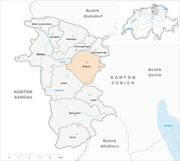
| Surrounded by | Dietikon, Oberengstringen, Uitikon, Unterengstringen, Urdorf, Zurich | |
| Website |
www SFSO statistics |
|
Schlieren (Zürich German Schlierä) is a municipality in the district of Dietikon in the canton of Zürich in Switzerland.
The oldest artifact discovered in the Canton of Zürich is a Stone Age Neanderthal hand axe which was found in Schlieren, and dates back to approximately 100,000 BCE.
Until 1415, Schlieren belonged to Habsburg. After the conquest of Aargau by the Swiss Confederates it was a component of the county of Baden. In 1803 Schlieren was assigned to the Canton of Zürich. In 1777 the minister Heinrich Keller created here the first "deaf-mute school" in Switzerland. Thanks to the proximity to the city of Zürich and the good traffic facilities (Tram, S-Bahn), Schlieren showed a population growth of 10,000 since the 1930s.
Schlieren was considered for inclusion of the expansion of Zurich's city limits, but was ultimately not part of the expansion of 1934.
Schlieren has an area of 6.6 km2 (2.5 sq mi). Of this area, 19.5% is used for agricultural purposes, while 28.1% is forested. Of the rest of the land, 50.7% is settled (buildings or roads) and the remainder (1.7%) is non-productive (rivers, glaciers or mountains). In 1996[update] housing and buildings made up 36.6% of the total area, while transportation infrastructure made up the rest (14.1%). Of the total unproductive area, water (streams and lakes) made up 1.8% of the area. As of 2007[update] 43.5% of the total municipal area was undergoing some type of construction.
Schlieren lies to the south of the river Limmat in the Limmat Valley (German: Limmattal), and west of Zurich. It is part of the Zurich metropolitan area.
...
Wikipedia


