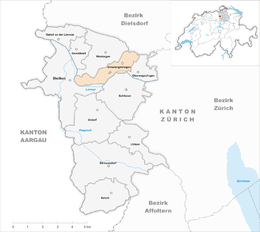
Unterengstringen
| Unterengstringen | ||
|---|---|---|
 |
||
|
||
| Coordinates: 47°25′N 8°27′E / 47.417°N 8.450°ECoordinates: 47°25′N 8°27′E / 47.417°N 8.450°E | ||
| Country | Switzerland | |
| Canton | Zurich | |
| District | Dietikon | |
| Area | ||
| • Total | 3.35 km2 (1.29 sq mi) | |
| Elevation | 416 m (1,365 ft) | |
| Population (Dec 2015) | ||
| • Total | 3,627 | |
| • Density | 1,100/km2 (2,800/sq mi) | |
| Postal code | 8103 | |
| SFOS number | 0249 | |
| Surrounded by | Dietikon, Oberengstringen, Regensdorf, Schlieren, Weiningen | |
| Website |
www SFSO statistics |
|
Unterengstringen is a municipality in the district of Dietikon in the canton of Zürich in Switzerland, located in the Limmat Valley (German: Limmattal).
Unterengstringen has an area of 3.3 km2 (1.3 sq mi). Of this area, 36.5% is used for agricultural purposes, while 26.9% is forested. Of the rest of the land, 33.2% is settled (buildings or roads) and the remainder (3.3%) is non-productive (rivers, glaciers or mountains). In 1996[update] housing and buildings made up 21.4% of the total area, while transportation infrastructure made up the rest (11.4%). Of the total unproductive area, water (streams and lakes) made up 3% of the area. As of 2007[update] 29.3% of the total municipal area was undergoing some type of construction.
The Ruine Glanzenberg is a ruined castle in the municipality, which is a Swiss heritage site of national significance.
Unterengstringen has a population (as of 31 December 2015) of 3,627. As of 2007[update], 19.7% of the population was made up of foreign nationals. As of 2008[update] the gender distribution of the population was 49.7% male and 50.3% female. Over the last 10 years the population has grown at a rate of 12%. Most of the population (as of 2000[update]) speaks German (87.4%), with Italian being second most common ( 3.0%) and French being third ( 1.6%).
...
Wikipedia


