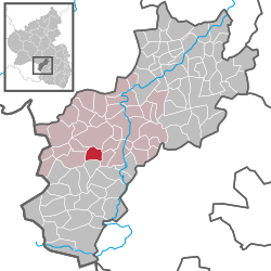
Schellweiler
| Schellweiler | ||
|---|---|---|
|
||
| Coordinates: 49°30′52.15″N 7°23′29.21″E / 49.5144861°N 7.3914472°ECoordinates: 49°30′52.15″N 7°23′29.21″E / 49.5144861°N 7.3914472°E | ||
| Country | Germany | |
| State | Rhineland-Palatinate | |
| District | Kusel | |
| Municipal assoc. | Kusel | |
| Government | ||
| • Mayor | Winfried Müller | |
| Area | ||
| • Total | 4.31 km2 (1.66 sq mi) | |
| Elevation | 290 m (950 ft) | |
| Population (2015-12-31) | ||
| • Total | 510 | |
| • Density | 120/km2 (310/sq mi) | |
| Time zone | CET/CEST (UTC+1/+2) | |
| Postal codes | 66869 | |
| Dialling codes | 06381 | |
| Vehicle registration | KUS | |
| Website | www.schellweiler.de | |
Schellweiler is an Ortsgemeinde – a municipality belonging to a Verbandsgemeinde, a kind of collective municipality – in the Kusel district in Rhineland-Palatinate, Germany. It belongs to the Verbandsgemeinde of Kusel, whose seat is in the like-named town.
The municipality lies in the Bledesbach valley, which stretches from Schellweiler to Wahnwegen along the highway between Kusel and Glan-Münchweiler. The valley is also known locally as the Saubeeretal. Forty-seven hectares of the municipal area’s 431 ha is wooded. Schellweiler is a clump village. The bottom of the valley lies roughly 280 m above sea level, and the land rises upwards on three sides. Only to the north does it remain even. The most heavily built-up area is on the eastern slope on the brook’s right bank, more than 300 m above sea level, at about the same elevation as the Autobahn A 62 (Kaiserslautern–Trier), which passes by. The built-up area reaches an elevation of about 320 m above sea level. The highest elevation within municipal limits is the top of the Kreuzberg at 402 m above sea level. The village’s structure could already be seen in a village plan from 1807, which showed two threads of building development coming from the south on the slopes on both the river’s left and right banks. Until 1980, this did not change. Up to 1939, building expansion could also be observed within the village. The most marked expansion came about after 1945, farther towards the slopes, but also northwards in the dale. The Petersgraben new building zone has been fully developed since 1996. All together, 60 new buildings, among them three built as multi-family dwellings, arose after the Second World War to make a total of roughly 160. Since 1985, Schellweiler has been recognized as a village renewal community. The former farming and working-class community has now become almost exclusively a residential community for commuters.
...
Wikipedia


