Savoy, Illinois
| Savoy | |
|---|---|
| Village | |
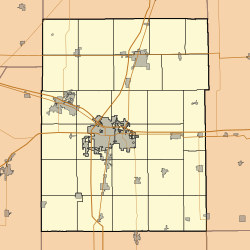
 Location of Savoy in Champaign County, Illinois. |
|
| Location within Champaign County | |
| Coordinates: 40°3′48″N 88°15′9″W / 40.06333°N 88.25250°WCoordinates: 40°3′48″N 88°15′9″W / 40.06333°N 88.25250°W | |
| Country | United States |
| State | Illinois |
| County | Champaign |
| Area | |
| • Total | 3.34 sq mi (8.64 km2) |
| • Land | 3.28 sq mi (8.48 km2) |
| • Water | 0.06 sq mi (0.16 km2) |
| Population (2010) | |
| • Total | 7,280 |
| • Estimate (2016) | 8,177 |
| • Density | 2,496.03/sq mi (963.74/km2) |
| Time zone | CST (UTC-6) |
| • Summer (DST) | CDT (UTC-5) |
| Postal code | 61874 |
| Area code(s) | 217 |
| FIPS code | 17-67860 |
Savoy is a village in Champaign County, Illinois, United States, and is its own political entity. The population was 7,280 at the 2010 census.
Savoy is located at 40°3′48″N 88°15′9″W / 40.06333°N 88.25250°W (40.063441, -88.252388).
According to the 2010 census, Savoy has a total area of 3.22 square miles (8.34 km2), of which 3.2 square miles (8.29 km2) (or 99.38%) is land and 0.02 square miles (0.05 km2) (or 0.62%) is water.
Savoy shares a border with the neighboring city of Champaign and is less than two miles from the site of the main campus of the University of Illinois. Savoy is a part of the Champaign-Urbana Metropolitan Area.
Savoy is serviced by US highway Route 45 (Dunlap Street) that runs into Champaign, Illinois at Neil Street. Savoy is also serviced by Interstate 57 that connects to Curtis Road at Exit 232 and Monticello Road at Exit 229.
The University of Illinois Willard Airport (KCMI) that serves the Champaign-Urbana community, with commercial airline service to Chicago O'Hare Airport and other destinations, is located on the south edge of Savoy.
At the 2000 census, there were 4,476 people, 2,032 households and 1,127 families residing in the village. The population density was 2,899.9 per square mile (1,122.2/km²). There were 2,099 housing units at an average density of 1,359.9 per square mile (526.3/km²). The racial makeup of the village was 81.41% White, 4.51% African American, 0.16% Native American, 10.84% Asian, 0.04% Pacific Islander, 0.78% from other races, and 2.26% from two or more races. Hispanic or Latino of any race were 2.12% of the population.
...
Wikipedia


