Savoie
| Savoie | |||
|---|---|---|---|
| Department | |||

Prefecture building of the Savoie department, in Chambéry
|
|||
|
|||
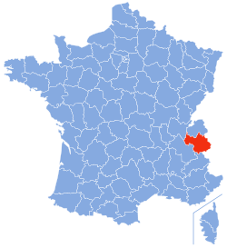
 Location of Savoie in France |
|||
| Coordinates: 45°35′N 6°20′E / 45.583°N 6.333°ECoordinates: 45°35′N 6°20′E / 45.583°N 6.333°E | |||
| Country | France | ||
| Region | Auvergne-Rhône-Alpes | ||
| Prefecture | Chambéry | ||
| Subprefectures |
Albertville Saint-Jean-de-Maurienne |
||
| Government | |||
| • President of the General Council | Hervé Gaymard (UMP) | ||
| Area | |||
| • Total | 6,028 km2 (2,327 sq mi) | ||
| Elevation | 1,595 m (5,233 ft) | ||
| Highest elevation | 3,855 m (12,648 ft) | ||
| Lowest elevation | 208 m (682 ft) | ||
| Population (2014) | |||
| • Total | 426,924 | ||
| • Rank | 57th | ||
| • Density | 71/km2 (180/sq mi) | ||
| Time zone | CET (UTC+1) | ||
| • Summer (DST) | CEST (UTC+2) | ||
| Department number | 73 | ||
| Arrondissements | 3 | ||
| Cantons | 19 | ||
| Communes | 292 | ||
| ^1 French Land Register data, which exclude estuaries, and lakes, ponds, and glaciers larger than 1 km2 | |||
Savoie (pronounced: [sa.vwa]; Arpitan: Savouè, Italian: Savoia [saˈvɔːja], English: Savoy /səˈvɔɪ/) is a French department in the Auvergne-Rhône-Alpes region of the French Alps.
Together with the Haute-Savoie, Savoie is one of the two departments of the historic region of Savoy that was annexed by France on 14 June 1860, following the signature of the Treaty of Turin on 24 March 1860. For history before 1860, details of the annexation, and modern regionalism, see Savoy.
It is widely accepted that Savoie takes its name from the Latin Sapaudia or Sabaudia, meaning land covered in fir trees. Savoie was long part of the states of Savoy; though beginning in the 16th century, it was occupied by France several times. It was integrated into the Mont-Blanc department from 1792 to 1815 (and partially into the Léman department from 1798 to 1814). The province was annexed by France in 1860. The former Duchy of Savoy became the two departments of Savoie and Haute-Savoie.
...
Wikipedia


