Sarid
| Sarid | |
|---|---|
 |
|
| Coordinates: 32°39′47.16″N 35°13′32.52″E / 32.6631000°N 35.2257000°ECoordinates: 32°39′47.16″N 35°13′32.52″E / 32.6631000°N 35.2257000°E | |
| District | Northern |
| Council | Jezreel Valley |
| Affiliation | Kibbutz Movement |
| Founded | 1926 |
| Founded by | Eastern European immigrants |
| Population (2015) | 851 |
| Website | www.sarid.org.il |
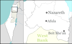
Sarid (Hebrew: שָׂרִיד) is a kibbutz in northern Israel. Located near Migdal HaEmek, it falls under the jurisdiction of Jezreel Valley Regional Council. In 2015 it had a population of 851.
During the Ottoman era a Muslim village called Ikhneifis (also Khanâfis and other versions), meaning "beetles", stood at the site of present Sarid. Kneffis, and the neighbouring towns and villages of Nazareth, Mejdal, Yafa, Jebatha and Ma'alul, paid taxes to the monks of Nazareth, who bought the right to collect these taxes from the Ottoman authorities in 1777 for two hundred dollars. Thirty years later, they again purchased this right, though this time for two thousands five hundred dollars, owing to the rise in the price of cereals and ground rents. A map from Napoleon's invasion of 1799 by Pierre Jacotin showed the place, named as Karm Ennefiiceh.
In 1882, the Palestine Exploration Fund's Survey of Western Palestine (SWP) found at Ikhneifis the "ruin of a tower built by Daher el-Omar about a century ago (1162 A.H.)."Gottlieb Schumacher, as part of surveying for the construction of the Jezreel Valley railway, noted in 1900 that Ikhneifis was a “flourishing village”, consisting of 52 huts and 230 inhabitants, and that the place was the property of the Sursocks, of Beirut.
Moshe Dayan mentioned it as an example of "there is not one place built in this country which did not have a former Arab population".
...
Wikipedia

