Saratoga, Wyoming
| Saratoga, Wyoming | |
|---|---|
| Town | |
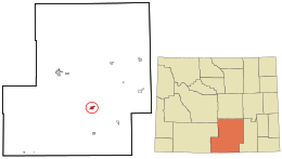
 Location in Carbon County and the state of Wyoming. |
|
| Location in the United States | |
| Coordinates: 41°27′16″N 106°48′30″W / 41.45444°N 106.80833°W | |
| Country | United States |
| State | Wyoming |
| County | Carbon |
| Area | |
| • Total | 3.59 sq mi (9.30 km2) |
| • Land | 3.40 sq mi (8.81 km2) |
| • Water | 0.19 sq mi (0.49 km2) |
| Elevation | 6,791 ft (2,070 m) |
| Population (2010) | |
| • Total | 1,690 |
| • Estimate (2012) | 1,663 |
| • Density | 497.1/sq mi (191.9/km2) |
| Time zone | Mountain (MST) (UTC-7) |
| • Summer (DST) | MDT (UTC-6) |
| ZIP code | 82331 |
| Area code | 307 |
| FIPS code | 56-68685 |
| GNIS feature ID | 1609150 |
| Website | http://www.saratoga.govoffice2.com/ |
Saratoga is a town in Carbon County, Wyoming, United States. The population was 1,690 at the 2010 census.
Saratoga is the home of the Steinley Cup microbrew competition, usually held in August at Veterans Island Park, a playground and picnic facility located on a small island in the North Platte River. There is also a public pool heated by a hot spring located in Saratoga. Saratoga is one of many western communities economically devastated by consolidation, automation and the changing business practices of multinational timber companies. The town's two largest employers now are the United States Forest Service and Carbon County School District No. 2, both public sector employers. The town's motto is, "Where The Trout Leap In Main Street." The local newspaper is the Saratoga Sun.
Saratoga is located at 41°27′16″N 106°48′30″W / 41.45444°N 106.80833°W (41.454474, -106.808413).
According to the United States Census Bureau, the town has a total area of 3.59 square miles (9.30 km2), of which, 3.40 square miles (8.81 km2) of it is land and 0.19 square miles (0.49 km2) is water.
As of the census of 2010, there were 1,690 people, 802 households, and 474 families residing in the town. The population density was 497.1 inhabitants per square mile (191.9/km2). There were 979 housing units at an average density of 287.9 per square mile (111.2/km2). The racial makeup of the town was 94.4% White, 0.9% Native American, 0.6% Asian, 2.2% from other races, and 1.9% from two or more races. Hispanic or Latino of any race were 5.1% of the population.
...
Wikipedia

