Santa Maria-Santa Barbara, CA Metropolitan Statistical Area
| Santa Barbara County, California | |||||||
|---|---|---|---|---|---|---|---|
| County | |||||||
| County of Santa Barbara | |||||||
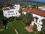
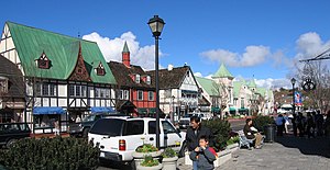
Images, from top down, left to right: The Santa Barbara County Courthouse; Lake Cachuma; Vandenberg Air Force Base's main gate; along Foxen Canyon Road, running between the Santa Maria and Santa Ynez Valleys; Danish-styled Solvang
|
|||||||
|
|||||||
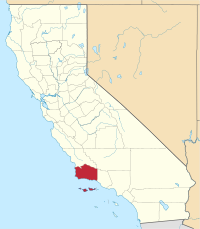
 Location in the state of California |
|||||||
 California's location in the United States |
|||||||
| Country | |||||||
| State |
|
||||||
| Region | California Central Coast | ||||||
| Incorporated | February 18, 1850 | ||||||
| County seat | Santa Barbara | ||||||
| Largest city |
Santa Maria (population) Santa Barbara (area) |
||||||
| Area | |||||||
| • Total | 3,789 sq mi (9,810 km2) | ||||||
| • Land | 2,735 sq mi (7,080 km2) | ||||||
| • Water | 1,054 sq mi (2,730 km2) | ||||||
| Highest elevation | 6,803 ft (2,074 m) | ||||||
| Population (April 1, 2010) | |||||||
| • Total | 423,895 | ||||||
| • Estimate (2015) | 444,769 | ||||||
| • Density | 110/sq mi (43/km2) | ||||||
| Time zone | Pacific Time Zone (UTC-8) | ||||||
| • Summer (DST) | Pacific Daylight Time (UTC-7) | ||||||
| Area code(s) | 805 | ||||||
| Website | www.countyofsb.org | ||||||
Santa Barbara County, California, officially the County of Santa Barbara, is a county located in the southern portion of the state of California, in the United States. As of the 2010 census, the population was 423,895. The county seat is Santa Barbara, and the largest city is Santa Maria.
Santa Barbara County comprises the Santa Maria-Santa Barbara, CA Metropolitan Statistical Area. Most of the county is part of the California Central Coast. Mainstays of the county's economy include engineering, resource extraction (particularly petroleum extraction and diatomaceous earth mining), winemaking, agriculture, and education. The software development and tourism industries are important employers in the southern part of the county.
Southern Santa Barbara County is sometimes considered the northern cultural boundary of Southern California.
The Santa Barbara County area, including the Northern Channel Islands, was first settled by Native Americans at least 13,000 years ago. Evidence for a Paleoindian presence has been found in the form of a fluted Clovis-like point found in the 1980s along the western Santa Barbara Coast, as well as the remains of Arlington Springs Man found on Santa Rosa Island in the 1960s. For thousands of years, the area was home to the Chumash tribe of Native Americans, complex hunter-gatherers who lived along the coast and in interior valleys leaving rock art in many locations including Painted Cave.
...
Wikipedia


