San Rufo
| San Rufo | ||
|---|---|---|
| Comune | ||
| Comune di San Rufo | ||
|
||
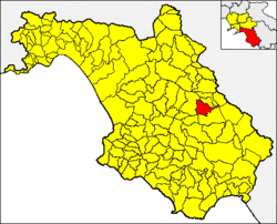
 San Rufo within the Province of Salerno |
||
| Location of San Rufo in Italy | ||
| Coordinates: 40°26′N 15°28′E / 40.433°N 15.467°E | ||
| Country | Italy | |
| Region | Campania | |
| Province / Metropolitan city | Salerno (SA) | |
| Frazioni | Fontana Vaglio | |
| Government | ||
| • Mayor | Gianna Pina Benvenga | |
| Area | ||
| • Total | 31 km2 (12 sq mi) | |
| Elevation | 640 m (2,100 ft) | |
| Population (1 December 2009) | ||
| • Total | 1,760 | |
| • Density | 57/km2 (150/sq mi) | |
| Demonym(s) | Rufini | |
| Time zone | CET (UTC+1) | |
| • Summer (DST) | CEST (UTC+2) | |
| Postal code | 84030 | |
| Dialing code | 0975 | |
| Website | Official website | |
San Rufo is a village and comune in the province of Salerno, in the Campania region of southern Italy. San Rufo extends over 31 square kilometres, much of which is mountainous or hilly terrain. With defence in mind, the old town was built at over 600 metres above sea level. Another reason for the choice of location was the marshy nature of the wide Vallo di Diano plain, which sits at an average 450 metres above sea level.
The town itself was located, and the surrounding countryside settled, on the slopes of Monte Cocuzzo delle Puglie and the Alburni Mountains. The two ranges face each other, forming an angle whose tip is scored by a narrow, deep valley: the Valtorno. This pass between the two mountain ranges, called "Passo della Sentinella", has since prehistoric times provided a strategic link between Vallo di Diano and Cilento regions. Indeed, the ancient "Via degli Stranieri" ("Strangers' Way"), a place name that beautifully illustrates the importance of the location, once passed through here.
The area where San Rufo now stands has been occupied over the centuries by a number of villages, the oldest of which was Casalvetere. Archaeological findings tell us that Casalvetere flourished in Roman times to the south west, near what is now the "Old Town". The village disappeared, probably in mediaeval times, and we know very little about its life. Casalvetere was the original home of the stone wayside post that now stands near the site of the Pellegrini Palace, on the main street crossing the town.
Further evidence of Roman settlements is also found in the archaeological remains occasionally found by farmers in the fields near Santa Maria Casenove and Campanella. These were the sites of the Roman pagi (administrative districts) in the vast Tegianum region. In 1926, the tomb of Gaius Luxilius Macer, dating from the 1st century A.D., was found in the Campanella district. Its inscription celebrates that he was undefeated, most probably in the chariot races in the Campus Martius in Rome.
In the 9th to 10th centuries, the village of Calvanello originated in response to the Saracen raids that plagued the valley and its plain. Calvanello was located at the opposite end of Casalvetere to what is now the old town, in a dominant position outside the castle of the same name. The ruins of the castle's guard tower and of the much larger building that housed the guards themselves can still be seen. But nothing visible remains of the village itself. Calvanello was laid out as a fortified village, a safe refuge for the inhabitants in times of siege. At some time, probably during the 13th to 14th centuries, the village was destroyed – it seems through a struggle for power with the nearby village of San Marzano. Oral sources claim that it was wiped out by the Castle of Teggiano. While it existed, it was undoubtedly a key site in the defence strategy of the Vallo di Diano, since it had an excellent vantage point from its elevated position.
...
Wikipedia


