San Marcos, California
| San Marcos, California | ||
|---|---|---|
| Charter city | ||
| City of San Marcos | ||

Looking North toward Lake San Marcos
|
||
|
||
| Nickname(s): Valley of Discovery | ||
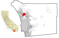
 Location in San Diego County and the state of California |
||
| Location in the United States | ||
| Coordinates: 33°8′31″N 117°10′13″W / 33.14194°N 117.17028°WCoordinates: 33°8′31″N 117°10′13″W / 33.14194°N 117.17028°W | ||
| Country |
|
|
| State |
|
|
| County | San Diego | |
| Incorporated | January 28, 1963 | |
| Chartered | July 4, 1994 | |
| Government | ||
| • Type | Council/Manager | |
| • Mayor | Jim Desmond | |
| Area | ||
| • Total | 24.390 sq mi (63.169 km2) | |
| • Land | 24.370 sq mi (63.117 km2) | |
| • Water | 0.020 sq mi (0.053 km2) 0.08% | |
| Population (April 1, 2010) | ||
| • Total | 83,781 | |
| • Estimate (2013) | 89,387 | |
| • Density | 3,400/sq mi (1,300/km2) | |
| Time zone | Pacific (UTC-8) | |
| • Summer (DST) | PDT (UTC-7) | |
| ZIP codes | 92069, 92078, 92079, 92096 | |
| Area codes | 442/760 | |
| FIPS code | 06-68196 | |
| GNIS feature IDs | 1661388, 2411797 | |
| Website | www |
|
San Marcos is a city in the North County region of San Diego County in the U.S. state of California. As of the 2010 census, the city's population was 83,781. It is the site of California State University San Marcos. The city is bordered by Escondido to the east, Encinitas to the southwest, Carlsbad to the west, and Vista to the northwest.
According to historical legends, the San Luis Rey Mission flocks were robbed by a small band of Native Americans in the late 18th century. Fleeing the Spanish troops, the Native Americans escaped to the hills. While pursuing the Native Americans, in 1797 the Spaniards came upon a fertile valley, which was named Los Vallecitos de San Marcos (Little Valleys of Saint Mark) to honor the day of discovery: April 25, St. Mark’s Day. On April 22, 1840, Governor Juan B. Alvarado granted Rancho Vallecitos de San Marcos to his relative, Jose María Alvarado. Jose Alvarado was killed at the Pauma Massacre in 1846, and the land was left to his wife; she then sold the land to Lorenzo Soto. In the late 1850s, Soto sold part of his land to Cave Couts, and his family was soon raising livestock. Although Cave Couts owned the land, Major Gustavus French Merriam from Topeka, Kansas, made the first permanent settlement. Merriam homesteaded 160 acres (0.65 km2) in the north Twin Oaks Valley and began wine and honey production.
After Major Merriam’s settlement, German and Dutch immigrants began moving into the area in the early 1880s. In 1883, a few miles south of the settlement, John H. Barham (for whom the present-day Barham Drive is named) founded the first town in the area, originally situated on the southeast corner of what are now Rancho Santa Fe Road and San Marcos Boulevard. By 1884, the town of Barham had a post office, blacksmith, feed store and weekly newspaper. In 1887, the San Marcos Land Company bought almost all of the San Marcos land formerly owned by the Couts family and promptly divided the land into tracts. Soon the beautiful hills began attracting home-seekers.
...
Wikipedia


