Encinitas, California
| Encinitas, California | ||
|---|---|---|
| City | ||
| City of Encinitas | ||

Aerial view of part of old town Encinitas showing Moonlight Beach on the left. Parallel with the shore is Historic Coast Highway 101, also parallel and further inland is Interstate 5 in California
|
||
|
||
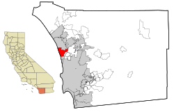
 Location of Encinitas within San Diego County, California |
||
| Location in the United States | ||
| Coordinates: 33°2′40″N 117°16′18″W / 33.04444°N 117.27167°WCoordinates: 33°2′40″N 117°16′18″W / 33.04444°N 117.27167°W | ||
| Country |
|
|
| State |
|
|
| County | San Diego | |
| Incorporated | October 1, 1986 | |
| Government | ||
| • Mayor | Catherine S. Blakespear | |
| Area | ||
| • Total | 19.990 sq mi (51.772 km2) | |
| • Land | 18.812 sq mi (48.722 km2) | |
| • Water | 1.178 sq mi (3.050 km2) 5.89% | |
| Elevation | 82 ft (25 m) | |
| Population (April 1, 2010) | ||
| • Total | 59,518 | |
| • Estimate (2013) | 61,588 | |
| • Density | 3,000/sq mi (1,100/km2) | |
| Demonym(s) | Encinitan | |
| Time zone | Pacific (UTC-8) | |
| • Summer (DST) | PDT (UTC-7) | |
| ZIP codes | 92007, 92023, 92024 | |
| Area codes | 442/760 | |
| FIPS code | 06-22678 | |
| GNIS feature IDs | 1652705, 2410440 | |
| Website | www |
|
Encinitas is a beach city in the North County area of San Diego County, California. Located within Southern California, it is approximately 25 miles (40 km) north of San Diego and about 95 miles (153 km) south of Los Angeles. As of the 2010 census, the city had a population of 59,518, up from 58,014 at the 2000 census.
Encinitas is a Spanish name meaning "little oaks".
The city was incorporated by 69.3% of the voters in 1986 from the communities of historic Encinitas, new Encinitas (Village Park, etc.), Leucadia, Cardiff-by-the-Sea and Olivenhain. The communities retain their identities and distinctive flavors.
Encinitas can be divided into five areas:
Encinitas is located at 33°2′40″N 117°16′18″W / 33.04444°N 117.27167°W. According to the United States Census Bureau, the city has a total area of 20.0 square miles (52 km2). 18.8 square miles (49 km2) of it is land and 1.2 square miles (3.1 km2) of it (5.89%) is water. The city's elevation ranges between sea level and 180 feet (55 m) above sea level.
Encinitas lies on rugged coastal terrain. The city is bisected by a low-lying coastal ridge that separates New and Old Encinitas. In the north of the city, the coast rises in elevation and the land is raised up in the form of many coastal bluffs. The city is surrounded by Batiquitos Lagoon and San Elijo Lagoon to the north and south, respectively.
...
Wikipedia


