San Jeronimo River
| Balsas River | |
|---|---|

Balsas River
|
|

Watersheds of Mexico
|
|
| Native name | Mezcala River |
| Country | Mexico |
| Physical characteristics | |
| River mouth | Mangrove Point, Pacific Ocean |
| Length | 771 kilometers (479 mi) |
| Basin features | |
| River system | Confluence of the San Martín River and Zahuapan River |
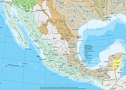
The Balsas River (Spanish Río Balsas, also locally known as the Mezcala River, or Atoyac River) is a major river of south-central Mexico.
The basin flows through the states of Puebla, Morelos, Guerrero, and Mexico. The river flows through the Sierra Madre del Sur, and empties into the Pacific Ocean at Mangrove Point, adjacent to the city of Lázaro Cárdenas, Michoacán. Several rapids along the course of the Balsas River limit its navigability and thus the river has been largely used for generation of hydroelectric power, flood control and irrigation.
The Balsas River valley was possibly one of the earliest maize growing sites in Mexico, dating from around 9200 years ago. Though it is known that successive communities of Yop, Coixica, Matlatzinca (Chontal), Tlahuica and Xochimilca with Nahua succeeding in the end have lived in the region, archeological excavations in the area are yet to establish the hierarchical succession of the various communities. During the period of 1100–480 BC, the region between the lower Balsas river valley and the Lerma-Santiago River fell under control of the Tarascan-Purépecha Empire.
According to the 1980 Census, 47,000 people lived along the Balsas river banks, spread over 37 communities, within the six municipalities of the region. Nahua peoples constite 47% of the population, 15% are indigenous people (speaking four different languages), other large communities are Mixtec (23%) and Tlapenc (19%), and the balance 4% are Amuzgo. The population increased to 60,000 in the 1990s. The communities, while retaining their individualities, show close linguistic, kinship, and cultural relationships - revealed, for example, when they perform the rituals of patronal feasts.
...
Wikipedia
