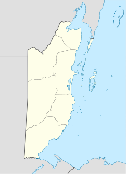
San Ignacio Cayo
| San Ignacio-Santa Elena | |
|---|---|
| Town | |
| Twin Towns of San Ignacio and Santa Elena | |

San Ignacio Town
|
|
| Nickname(s): Cayo, Cayo Town, Twin Towns | |
| Motto: The Best Come From The West | |
| Coordinates: 17°09′32″N 89°04′11″W / 17.1588°N 89.0696°WCoordinates: 17°09′32″N 89°04′11″W / 17.1588°N 89.0696°W | |
| Country |
|
| District | Cayo |
| Constituency | Cayo Central, Cayo North, Cayo North East |
| Founded | 1800s |
| Government | |
| • Mayor | Earl Trapp (UDP) |
| • Area Representatives |
Omar Figueroa (UDP) Rene Montero (UDP) Orlando Habet (PUP) |
| Area | |
| • Total | 6 km2 (2.5 sq mi) |
| Elevation | 76 m (249 ft) |
| Population (2010) | |
| • Total | 17,878 |
| • Estimate (2015) | 20,582 |
| Time zone | Central (UTC-6) |
| Climate | Aw |
| Website | www |
San Ignacio and Santa Elena are towns in western Belize. San Ignacio serves as the cultural-economic hub of Cayo District. It got its start from Mahogany and chicle production during British colonialism. Over time it attracted people from the surrounding areas, which led to the diverse population of the town today. San Ignacio is the largest settlement in Cayo District and the second largest in the country, after Belize City.
The town was originally named El Cayo by the Spanish. On October 19, 1904, El Cayo was officially declared a town by the government of British Honduras. In the past a creek ran between the Macal and the Mopan rivers one mile outside of San Ignacio going toward Benque Viejo. This creek then fulfilled the definition of an area of land completely surrounded by water and thus the name Cayo, "island". There was a large wooden bridge across this creek in the late 1940s, but since the creek eventually dried up, the area was filled with limestone gravel and today there remains no evidence of its existence. The demise of the creek, however, took away the distinction for the classification of a 'cayo' from the venerable western town of 'El Cayo' and returned it to a regular land mass.
San Ignacio is situated on the banks of the Macal River, about 63 miles (101 km) west of Belize City and 22 miles (35 km) west of the country's capital: Belmopan. The town has an area of approximately 2.5 square miles (6.5 km2).
Street scene in San Ignacio
View of San Ignacio, looking towards the Hawkesworth Bridge
Burns Avenue
Small park of downtown San Ignacio in front of the police station
Belize independence day celebration
The population is largely Mestizo and Kriol, with some Lebanese and Mopan. San Ignacio also boasts a fairly large Chinese population, most of whom emigrated from Guangzhou in waves in the mid-20th century. The Mennonite community of Spanish Lookout is situated a few miles outside San Ignacio. The 2010 census counted 17,878 inhabitants in San Ignacio and Santa Elena, of whom 8,751 are males and 9,127 are females. The total number of households is 4,351 and the average household size is 4.1.
...
Wikipedia

