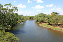
Macal River
| Macal | |
|---|---|

Macal River in Belize
|
|
| Country | Belize |
| Basin features | |
| Main source |
Maya Mountains 953 m (3,127 ft) (Cooma Cairn) |
| River mouth | Belize River |
| Basin size | 1,492 km2 (576 sq mi) |
| Physical characteristics | |
| Length | 320 km (200 mi) |
The Macal River is a river running through Cayo District in western Belize. Sites along the river include the ancient Mayan town of Cahal Pech and the Belize Botanic Gardens. The Macal River discharges to the Belize River. There are several tributaries to the Macal River including the following streams: Privassion, Rio On, Rio Frio, Mollejon and Cacao Camp.
The size of the Macal River catchment basin is approximately 1492 square kilometers. The Macal River rises in a rugged portion of the Maya Mountains and flows in a northerly direction where it joins with the Mopan River to form the Belize River. Lying to the east of the Macal River Basin is the Cockscomb Basin Wildlife Sanctuary, the premier sanctuary established specifically for conservation of the jaguar.
Due to the steep terrain of the headwaters region and the high rainfall of the upper Macal Basin, the Macal River is subject to rapid stage height rise, contributing significantly to the downstream flooding of the Belize River. By legend, the river is named after a beautiful young girl Macall, an uncommon name. The lower river is navigated year-around with canoes.
The Macal Rivershed is divided into two sub catchment basins. The headwaters and upper basin comprise about 1000 square kilometers and rest in the southern Maya Mountains, whilst the lower basin is known as the Mountain Pine Ridge catchment. The soils in the upper watershed tend to be shallow and rocky, leading to rapid runoff. All of the upper catchment tributaries join the mainstem channel considerably before Guacamayo, the approximate join point of the two connecting sub-sheds of the Macal River. Peak flows follow the rainy season of June to August, with tailing rains until February; lowest flows are in the dry season from March to May.
For the lower Macal River catchment (or Mountain Pine Ridge area), tributary streams are arranged radially to feed the mainstem; principal lower basin rivers are the Privassion, Rio On, Rio Frio, Mollejon, Chaa Creek and Cacao Camp. In the lower catchment basin, there is considerable overland friction to surface runoff due to the dense terrestrial detrititus and understory on the forest floor, even though the forest canopy itself is sometimes sparse. The retarded runoff of this lower sub-watershed allows the rapid peak runoff of the upper watershed to overtake the flow within Mountain Pine Ridge, forming an effective single massive peak wave, which exacerbates downstream flooding in the Belize River, and, in fact, controls the flood stage of the larger Belize River. This effect of simultaneous peak flow is further enhanced by the radial geometry of the lower Macal Basin tributaries, encouraging all sub-basin flow to reach the mainstem at approximately the same time.
...
Wikipedia
