San Bruno, CA
| San Bruno | ||
|---|---|---|
| City | ||
| City of San Bruno | ||

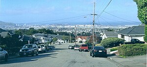
San Bruno looking toward San Francisco Bay (2006)
|
||
|
||
| Motto: "City with a Heart" | ||
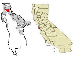
 Location in San Mateo County and the state of California |
||
| Location in the United States | ||
| Coordinates: 37°37′31″N 122°25′31″W / 37.62528°N 122.42528°WCoordinates: 37°37′31″N 122°25′31″W / 37.62528°N 122.42528°W | ||
| Country | United States | |
| State | California | |
| County |
|
|
| Region | San Francisco Bay Area | |
| Region | Northern California | |
| Incorporated | December 23, 1914 | |
| Government | ||
| • Mayor | Jim Ruane | |
| Area | ||
| • Total | 5.478 sq mi (14.188 km2) | |
| • Land | 5.478 sq mi (14.188 km2) | |
| • Water | 0 sq mi (0 km2) 0% | |
| Elevation | 20 ft (6 m) | |
| Population (April 1, 2010) | ||
| • Total | 41,114 | |
| • Estimate (2014) | 43,009 | |
| • Density | 7,851/sq mi (3,031/km2) | |
| Time zone | Pacific (UTC−8) | |
| • Summer (DST) | PDT (UTC−7) | |
| ZIP codes | 94066, 94067, 94096, 94098 | |
| Area code | 650 | |
| FIPS code | 06-65028 | |
| GNIS feature IDs | 277616, 2411778 | |
| Website | sanbruno |
|
San Bruno is a city in San Mateo County, California, United States, incorporated in 1914. The population was 41,114 at the 2010 United States Census. The city is located between South San Francisco and Millbrae, adjacent to San Francisco International Airport and Golden Gate National Cemetery, and is approximately 12 miles (19 km) south of downtown San Francisco.
The city is located between South San Francisco and Millbrae, adjacent to San Francisco International Airport and Golden Gate National Cemetery, and is approximately 12 miles (19 km) south of downtown San Francisco.
According to the United States Census Bureau, the city has a total area of 5.5 square miles (14 km2), all of it land. The city spreads from the mostly flat lowlands near San Francisco Bay into the foothills of the Santa Cruz Mountains, which rise to more than 600 feet (180 m) above sea level in Crestmoor and more than 700 feet (210 m) above sea level in Portola Highlands. San Bruno City Hall sits at an official elevation of 41 feet (12.5 m) above sea level.
Portions of Mills Park, Crestmoor, and Rollingwood are very hilly, featuring canyons and ravines. Creeks, many of them now in culverts, flow from springs in the hills toward San Francisco Bay. Just west of Skyline Boulevard and outside of city limits is San Andreas Lake, which got its name from the San Andreas Fault. The lake is one of several reservoirs used by the San Francisco Water Department, providing water to San Francisco and several communities in San Mateo County, including San Bruno west of I-280.
...
Wikipedia


