Millbrae
| City of Millbrae | ||
|---|---|---|
| General law city | ||

General view of Millbrae
|
||
|
||
| Motto: A City In The Sun | ||
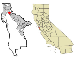
 Location in San Mateo County and the state of California |
||
| Location in the United States | ||
| Coordinates: 37°36′3″N 122°24′5″W / 37.60083°N 122.40139°WCoordinates: 37°36′3″N 122°24′5″W / 37.60083°N 122.40139°W | ||
| Country |
|
|
| State |
|
|
| County | San Mateo | |
| Incorporated | January 14, 1948 | |
| Government | ||
| • Type | Council-manager | |
| • Mayor | Anne Oliva | |
| Area | ||
| • Total | 3.259 sq mi (8.439 km2) | |
| • Land | 3.247 sq mi (8.409 km2) | |
| • Water | 0.012 sq mi (0.030 km2) 0.36% | |
| Elevation | 33 ft (10 m) | |
| Population (April 1, 2010) | ||
| • Total | 21,532 | |
| • Estimate (2014) | 22,703 | |
| • Density | 6,992/sq mi (2,700/km2) | |
| Time zone | Pacific (UTC-8) | |
| • Summer (DST) | PDT (UTC-7) | |
| ZIP code | 94030 | |
| Area code(s) | 650 | |
| FIPS code | 06-47486 | |
| GNIS feature ID | 1659756 | |
| Website | www |
|
Millbrae is a city in San Mateo County, California, United States, just west of San Francisco Bay, with San Bruno on the north and Burlingame on the south. The population was 21,536 at the 2010 census.
Darius Ogden Mills purchased land in the 1860s from the Sanchez family to build a country estate. The former Mills estate was bordered by what is now Skyline Boulevard, Bayshore Highway U.S. Route 101, Millbrae Avenue and Trousdale Drive. The estate became known as "Millbrae" from "Mills" and the Scottish word "brae," which means "rolling hills" or "hill slope." Children swam in three lakes situated on the estate and sold acacias to tourists before the Mills family began to sell the land for development. The estate's spectacular mansion burned down during a realistic "fire drill" in 1954.
Millbrae used a private patrol financed by fees from merchants and residents until 1941, when the San Mateo County Board of Supervisors created the Millbrae Police District. Records of the Internal Revenue Service document the licensing of several Millbrae bars for gambling; only after incorporation were gambling laws enforced in Millbrae and not until the 1950s was gambling defeated. In 1931, citizens organized a volunteer fire department, which remained entirely volunteer until 1938. The police and fire departments were housed together for several years at Hillcrest Boulevard and El Camino Real before the vital services moved to their permanent location in Millbrae's civic center, a few blocks west of El Camino.
For many Millbrae residents, the original Sixteen Mile House was a direct link to Millbrae's early days. The rest stop was built in 1872 by members of the Sanchez family, the original landholders of the Rancho Buri Buri, which at one time comprised parts of present-day Millbrae and Burlingame. The building faced demolition but was moved to its current location on Broadway and serves today as a tavern and restaurant.
...
Wikipedia


