Burlingame, California
| Burlingame, California | ||
|---|---|---|
| City | ||
| City of Burlingame | ||

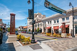
Burlingame Avenue
|
||
|
||
 Location in San Mateo County and the U.S. state of California |
||
| Location in the United States | ||
| Coordinates: 37°35′0″N 122°21′49″W / 37.58333°N 122.36361°WCoordinates: 37°35′0″N 122°21′49″W / 37.58333°N 122.36361°W | ||
| Country | United States | |
| State | California | |
| County | San Mateo | |
| Incorporated | June 6, 1908 | |
| Named for | Anson Burlingame | |
| Government | ||
| • Mayor | Ann Keighran | |
| • City manager | Lisa Goldman | |
| Area | ||
| • Total | 6.057 sq mi (15.686 km2) | |
| • Land | 4.406 sq mi (11.411 km2) | |
| • Water | 1.651 sq mi (4.275 km2) 27.25% | |
| Elevation | 39 ft (12 m) | |
| Population (April 1, 2010) | ||
| • Total | 28,806 | |
| • Estimate (2014) | 30,298 | |
| • Density | 6,877/sq mi (2,655/km2) | |
| Time zone | Pacific (UTC-8) | |
| • Summer (DST) | PDT (UTC-7) | |
| ZIP codes | 94010–94012 | |
| Area code | 650 | |
| FIPS code | 06-09066 | |
| GNIS feature IDs | 1659704, 2409945 | |
| Website | www |
|
|
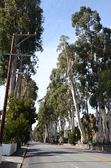
Howard-Ralston Eucalyptus Tree Rows
|
|
 |
|
| Location | El Camino Real, Burlingame, CA |
|---|---|
| Built | 1873–1876 |
| NRHP Reference # | 12000127 |
| Added to NRHP | March 15, 2012 |
Burlingame is a city in San Mateo County, California. It is located on the San Francisco Peninsula and has a significant shoreline on San Francisco Bay. The city is named after diplomat Anson Burlingame and is often referred to as the City of Trees due to the number of trees within the city and its numerous eucalyptus groves. Burlingame is known for its high residential quality of life with a walkable downtown area and excellent public school system. The current median home value in Burlingame is $1.8M+ and as of the 2010 U.S. Census, Burlingame had a population of 28,807.
Burlingame is situated on land previously owned by San Francisco-based merchant William Davis Merry Howard. Howard planted many eucalyptus trees on his property and retired to live on the land. Howard died in 1856 and the land was sold to William C. Ralston, a prominent banker. In 1868, Ralston named the land after his friend, Anson Burlingame, the United States Ambassador to China. After the 1906 San Francisco earthquake, hundreds of lots in Burlingame were sold to people looking to establish new homes, and the town of Burlingame was incorporated in 1908. In 1910, the neighboring town of Easton was annexed and this area is now known as the Easton Addition neighborhood of Burlingame.
Burlingame is known as the City of Trees due to the number of trees within the city (18,000 public trees). In 1908, the Burlingame board of trustees passed an ordinance "prohibiting cutting, injuring, or destroying trees". The city also has many parks and Eucalyptus groves that add to the overall tree numbers.
There are four highways passing through Burlingame. Highway 101 runs near the bay running fromSan Jose to San Francisco. Highway 82, also known as El Camino Real, follows a parallel course. Highway 35 connects with Interstate 280.
...
Wikipedia


