San Benito County (California)
| San Benito County, California | |||||
|---|---|---|---|---|---|
| County | |||||
| County of San Benito | |||||
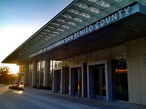
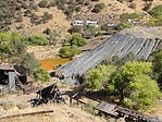
Images, from top down, left to right: San Benito County Courthouse, Mission San Juan Bautista, New Idria grounds
|
|||||
|
|||||
 Location in the U.S. state of California |
|||||
 California's location in the United States |
|||||
| Country |
|
||||
| State |
|
||||
| Region | Central Coast | ||||
| CSA | San Jose-San Francisco-Oakland | ||||
| Metro | San Jose-Sunnyvale-Santa Clara | ||||
| Incorporated | 1874 | ||||
| Named for | Saint Benedict of Nursia | ||||
| County seat | Hollister | ||||
| Area | |||||
| • Total | 3,600 km2 (1,390 sq mi) | ||||
| • Land | 3,600 km2 (1,389 sq mi) | ||||
| • Water | 5 km2 (1.8 sq mi) | ||||
| Highest elevation | 1,599 m (5,245 ft) | ||||
| Population (April 1, 2010) | |||||
| • Total | 55,269 | ||||
| • Estimate (2016) | 59,414 | ||||
| • Density | 15/km2 (40/sq mi) | ||||
| Time zone | Pacific Time Zone (UTC−8) | ||||
| • Summer (DST) | Pacific Daylight Time (UTC−7) | ||||
| Area code | 831 | ||||
| FIPS code | 06-069 | ||||
| GNIS feature ID | 277299 | ||||
| Website | www |
||||
San Benito County is a county located in the Coast Range Mountains of the U.S. state of California. As of the 2010 census, the population was 55,269. The county seat is Hollister.
San Benito County is included in the San Jose-Sunnyvale-Santa Clara, CA Metropolitan Statistical Area, which is also included in the San Jose-San Francisco-Oakland, CA Combined Statistical Area.
El Camino Real passes through the county and includes one mission in San Juan Bautista.
San Benito County was formed from parts of Monterey County in 1874.
The county is named after the San Benito Valley. Father Juan Crespí, in his expedition in 1772, named a small river in honor of San Benedicto (Saint Benedict), the patron saint of the married, and it is from the contraction of this name that the county took its name.
...
Wikipedia


