Samarlakota
| Samalkota | |
|---|---|
| Town | |
 |
|
| Location in Andhra Pradesh, India | |
| Coordinates: 17°03′11″N 82°10′10″E / 17.0531°N 82.1695°ECoordinates: 17°03′11″N 82°10′10″E / 17.0531°N 82.1695°E | |
| Country | India |
| State | Andhra Pradesh |
| District | East Godavari |
| Area | |
| • Total | 14.88 km2 (5.75 sq mi) |
| Elevation | 9 m (30 ft) |
| Population (2011) | |
| • Total | 56,864 |
| • Density | 3,800/km2 (9,900/sq mi) |
| Languages | |
| • Official | Telugu |
| Time zone | IST (UTC+5:30) |
| PIN | 533 440 |
| Telephone code | +91-884 |
| Vehicle registration | AP 05 |
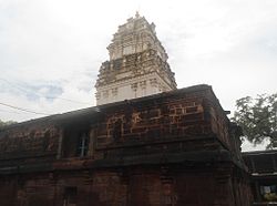
Samalkota is a town in East Godavari district of the Indian state of Andhra Pradesh. The town also forms a part of Godavari Urban Development Authority. Previously spelled as Samulcottah
Samarlakota is located at 17°03′00″N 82°11′00″E / 17.0500°N 82.1833°E. It has an average elevation of 9 meters (32 feet).
The Andhra Pradesh State Road Transport Corporation operates bus services from Samalkota bus station.Samarlakota railway station is an important railway junction on the Visakhapatnam-Vijayawada section of Howrah-Chennai main line. The railway line to Kakinada branches at this railway junction.One more advantage is Bus Station and Railway Station are situated opposite to each other.The nearest airport, at 64 km (40 mi), is in Rajahmundry, and the nearest international airport, 161 km (100 mi), is Visakhapatnam (Vizag).
Samalkot is a Municipality city in district of East Godavari, Andhra Pradesh. The Samalkot city is divided into 18 wards for which elections are held every 5 years. The Samalkot Municipality has population of 56,864 of which 28,115 are males while 28,749 are females as per report released by Census India 2011.
...
Wikipedia

