Salta Basin
| Salta Basin | |
|---|---|
| Cuenca Salta | |
| Etymology | Salta Province |
| Region | Argentine Northwest |
| Country |
|
| State(s) |
Salta, Tucumán Cochabamba Antofagasta |
| Cities | Salta |
| Characteristics | |
| On/Offshore | Onshore |
| Boundaries | Andes |
| Part of | Andean foreland basins |
| Geology | |
| Basin type |
Foreland-on-rift basin or intracontinental rift basin |
| Plate | South American |
| Orogeny | Andean |
| Age | Neocomian-Neogene |
| Stratigraphy | Stratigraphy |
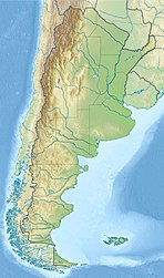
Salta Basin or Salta Rift Basin is a sedimentary basin located in the Argentine Northwest. The basin started to accumulate sediments in the Early Cretaceous (Neocomian) and at present it has sedimentary deposits reaching thicknesses of 5,000 metres (16,000 ft). The basin contains seven sub-basins: Tres Cruces, Lomas de Olmedo, Metán, Alemanía, Salfity, El Rey, Sey and Brealito. The basin environment has variously been described as a "foreland rift" and an "intra-continental rift". The basin developed under conditions of extensional tectonics and rift-associated volcanism.
The basin basement is composed of rocks belonging to the Puncoviscana Formation. The volcanism that began in the Late Jurassic was initially of subalkaline character (low sodium and potassium content), but turned increasingly alkaline in the Early Cretaceous.
The rifts of Salta Basin developed in a time of generalized extensional tectonics along western South America. It has been proposed that the Salar de Atacama depression in Chile was once a westward rift arm of the Salta Basin.
...
Wikipedia

