Sainte-Clotilde, Quebec
| Sainte-Clotilde | |
|---|---|
| Municipality | |
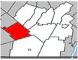
 Location within Les Jardins-de-Napierville RCM. |
|
| Location in southern Quebec. | |
| Coordinates: 45°09′N 73°41′W / 45.150°N 73.683°WCoordinates: 45°09′N 73°41′W / 45.150°N 73.683°W | |
| Country |
|
| Province |
|
| Region | Montérégie |
| RCM | Les Jardins-de-Napierville |
| Constituted | April 2, 1885 |
| Government | |
| • Mayor | Clément Lemieux |
| • Federal riding | Beauharnois—Salaberry |
| • Prov. riding | Huntingdon |
| Area | |
| • Total | 78.80 km2 (30.42 sq mi) |
| • Land | 78.73 km2 (30.40 sq mi) |
| Population (2011) | |
| • Total | 1,704 |
| • Density | 21.6/km2 (56/sq mi) |
| • Pop 2006-2011 |
|
| • Dwellings | 669 |
| Time zone | EST (UTC−5) |
| • Summer (DST) | EDT (UTC−4) |
| Postal code(s) | J0L 1W0 |
| Area code(s) | 450 and 579 |
| Highways |
|
| Geocode | 68020 |
| Website | www |
Sainte-Clotilde is a municipality in the Jardins de Napierville Regional County Municipality in Quebec, Canada, situated in the Montérégie administrative region. The population as of the Canada 2011 Census was 1,704.
Before February 6, 2010 it was known as Sainte-Clotilde-de-Châteauguay.
...
Wikipedia

