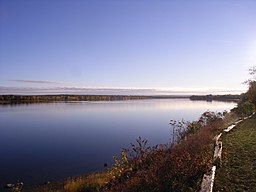
Saint John River (Maine)
| Designations | |
|---|---|
| Official name | Wolastoq National Historic Site of Canada |
| Designated | 2011 |
The Saint John River (French: Fleuve Saint-Jean) is a river, approximately 418 miles (673 km) long, located principally in the Canadian province of New Brunswick but also in and arising from the province of Quebec and the U.S. state of Maine. It forms part of the Canada–United States border in two different places along its length. The river drains an area of approximately 55,000 square kilometres (21,000 sq mi), of which slightly more than half is located in New Brunswick. Along that portion of the Atlantic shoreline of North America that lies between the St. Lawrence River and the Mississippi River, the Saint John River is the second longest waterway; only the Susquehanna is longer. It has been nicknamed the "Rhine of North America" for its scenery. The river is regulated by hydro power dams located at Mactaquac, Beechwood, and Grand Falls, New Brunswick.
The Baker Branch of the Saint John River rises in the Saint John Ponds of Somerset County in northwestern Maine. The Southwest Branch of the Saint John River originates in Little Saint John Lake on the Maine–Quebec border near Saint-Zacharie, Quebec, and forms the international boundary between Maine and Quebec as it flows northeasterly to join the Baker Branch in northern Somerset County. The Northwest Branch of the Saint John River rises from Lac Frontière in Montmagny Regional County Municipality near the southeastern Quebec border and flows southerly through Maine to a confluence with the Daaquam River and then easterly to a confluence with the Southwest Branch.
...
Wikipedia


