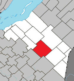
Saint-Paul-de-Montminy, Quebec
| Saint-Paul-de-Montminy | |
|---|---|
| Municipality | |
 Location within La Matapédia RCM. |
|
| Location in province of Quebec. | |
| Coordinates: 46°44′N 70°22′W / 46.733°N 70.367°WCoordinates: 46°44′N 70°22′W / 46.733°N 70.367°W | |
| Country |
|
| Province |
|
| Region | Chaudière-Appalaches |
| RCM | Montmagny |
| Constituted | January 1, 1862 |
| Government | |
| • Mayor | Émile Tanguay |
| • Federal riding | Montmagny—L'Islet— Kamouraska—Rivière- du-Loup |
| • Prov. riding | Côte-du-Sud |
| Area | |
| • Total | 163.80 km2 (63.24 sq mi) |
| • Land | 162.72 km2 (62.83 sq mi) |
| Population (2011) | |
| • Total | 824 |
| • Density | 5.1/km2 (13/sq mi) |
| • Pop 2006-2011 |
|
| • Dwellings | 550 |
| Time zone | EST (UTC−5) |
| • Summer (DST) | EDT (UTC−4) |
| Postal code(s) | G0R 3Y0 |
| Area code(s) | 418 and 581 |
| Highways |
|
| Website | www demontminy |
Saint-Paul-de-Montminy is a village of 864 people located in the Montmagny Regional County Municipality, Quebec. Geographically it is located in the Notre Dame Mountains, one of the Canadian parts of the Appalachian Mountains. It was founded in 1862.
...
Wikipedia

