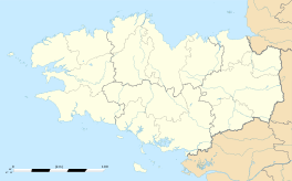
Saint-Marcel, Morbihan
|
Saint-Marcel Sant-Marc'hell |
|
|---|---|
| Commune | |

The town hall in Saint-Marcel
|
|
| Coordinates: 47°48′18″N 2°25′03″W / 47.805°N 2.4175°WCoordinates: 47°48′18″N 2°25′03″W / 47.805°N 2.4175°W | |
| Country | France |
| Region | Brittany |
| Department | Morbihan |
| Arrondissement | Vannes |
| Canton | Malestroit |
| Intercommunality | Val d'Oust et de Lanvaux |
| Government | |
| • Mayor (2008—2014) | Henri Briand |
| Area1 | 12.81 km2 (4.95 sq mi) |
| Population (1999)2 | 854 |
| • Density | 67/km2 (170/sq mi) |
| Time zone | CET (UTC+1) |
| • Summer (DST) | CEST (UTC+2) |
| INSEE/Postal code | 56228 /56140 |
| Elevation | 12–112 m (39–367 ft) |
|
1 French Land Register data, which excludes lakes, ponds, glaciers > 1 km² (0.386 sq mi or 247 acres) and river estuaries. 2Population without double counting: residents of multiple communes (e.g., students and military personnel) only counted once. |
|
1 French Land Register data, which excludes lakes, ponds, glaciers > 1 km² (0.386 sq mi or 247 acres) and river estuaries.
Saint-Marcel (Breton: Sant-Marc'hell) is a commune in the Morbihan department of Brittany in north-western France.
Saint-Marcel houses the Museum of the Breton Resistance which commemorates the uprising of the Maquis of Saint-Marcel (3,000 fighters) and 200 Free French SAS parachutists in 18 June 1944, which the French force under command of Colonel Morice (Paul Chenailler), Free French Pierre Bourgoin and André Hue came under German attack.
...
Wikipedia


