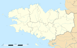
Saint-Lunaire
|
Saint-Lunaire Sant-Luner |
||
|---|---|---|

Grand Hotel
|
||
|
||
| Coordinates: 48°38′07″N 2°06′27″W / 48.6353°N 2.1075°WCoordinates: 48°38′07″N 2°06′27″W / 48.6353°N 2.1075°W | ||
| Country | France | |
| Region | Brittany | |
| Department | Ille-et-Vilaine | |
| Arrondissement | Saint-Malo | |
| Canton | Dinard | |
| Intercommunality | Côte d'Emeraude | |
| Government | ||
| • Mayor (2014–2020) | Michel Penhouët | |
| Area1 | 10.27 km2 (3.97 sq mi) | |
| Population (2009)2 | 2,309 | |
| • Density | 220/km2 (580/sq mi) | |
| Time zone | CET (UTC+1) | |
| • Summer (DST) | CEST (UTC+2) | |
| INSEE/Postal code | 35287 /35800 | |
| Elevation | 0–64 m (0–210 ft) (avg. 21 m or 69 ft) |
|
|
1 French Land Register data, which excludes lakes, ponds, glaciers > 1 km² (0.386 sq mi or 247 acres) and river estuaries. 2Population without double counting: residents of multiple communes (e.g., students and military personnel) only counted once. |
||
1 French Land Register data, which excludes lakes, ponds, glaciers > 1 km² (0.386 sq mi or 247 acres) and river estuaries.
Saint-Lunaire (Breton: Sant-Luner) is a commune in the Ille-et-Vilaine department in Brittany in northwestern France.
Fantastic viewpoints on the Pointe du Décollé, hill of La Garde Guérin and the Pointe du Nick.
Evidence of neolithic settlement remains in the form of a stone path (dolmen) (2000–5000 BC) at Plate-Roche.
The Roman conquest had little impact on the ancient settlement of farmer-fishermen. Far greater changes occurred several centuries later, with the Saxons and Frisons invasions in the early sixth century. In 513, King Arthur landed on the island of Cézembre, just facing the coast, with the new King of Armorica, Hoël I. This new regime favoured the settlement of missionaries from Cornwall, and in particular one of King Hoël's sons, Saint Lunarius (or Léonor), together with Saint Pompeius (or Coupaia), Saint Tugdual's brother, or Saint Sève and numerous monks and secular priests, who started clearing the local forest of Ponthul and erected a first chapel on the location of the present "Old Church".
According to one story, the local bishop granted a bell to St Lunarius and, with it, authority over all the hamlets lying within the sound of the bell. This area roughly corresponds to the old feudal lordship of Ponthual and, later, the municipality of Saint-Lunaire. The legend states that the inhabitants of a hamlet on the eastern edge of this area tried to maintain their independence by denying that they had heard the bell. This might explain the origins of the name of the suburb of "La Fourberie" ('Deceit' or 'Cunning'), next to Dinard.
Saint-Léonor thus became the main borough of the lordship of Ponthual, surrounded by various dependent hamlets. During the eleventh century, the family of Ponthual built the Old Church ("la Vieille Eglise"), which is one of the relatively rare romanesque churches of Brittany.
The town's name changed to "Saint-Léonaire de Ponthual" at the end of the seventeenth century and then to "Saint-Lunaire de Ponthual".
...
Wikipedia


