Saint-Hilaire-des-Landes
|
Saint-Hilaire-des-Landes Sant-Eler-al-Lann |
||
|---|---|---|
| Commune | ||

The Château de La Haye, in Saint-Hilaire-des-Landes
|
||
|
||
| Coordinates: 48°21′08″N 1°21′24″W / 48.3522°N 1.3567°WCoordinates: 48°21′08″N 1°21′24″W / 48.3522°N 1.3567°W | ||
| Country | France | |
| Region | Brittany | |
| Department | Ille-et-Vilaine | |
| Arrondissement | Fougères-Vitré | |
| Canton | Antrain | |
| Intercommunality | Coglai | |
| Government | ||
| • Mayor (2014–2020) | Claude Hamard | |
| Area1 | 18.27 km2 (7.05 sq mi) | |
| Population (2009)2 | 988 | |
| • Density | 54/km2 (140/sq mi) | |
| Time zone | CET (UTC+1) | |
| • Summer (DST) | CEST (UTC+2) | |
| INSEE/Postal code | 35280 /35140 | |
| Elevation | 54–117 m (177–384 ft) (avg. 115 m or 377 ft) |
|
|
1 French Land Register data, which excludes lakes, ponds, glaciers > 1 km² (0.386 sq mi or 247 acres) and river estuaries. 2Population without double counting: residents of multiple communes (e.g., students and military personnel) only counted once. |
||
1 French Land Register data, which excludes lakes, ponds, glaciers > 1 km² (0.386 sq mi or 247 acres) and river estuaries.
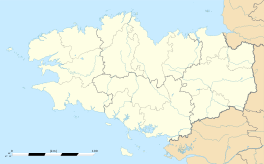
Saint-Hilaire-des-Landes (Breton: Sant-Eler-al-Lann) is a commune in the Ille-et-Vilaine department in Brittany in northwestern France.
Saint-Hilaire-des-Landes is located 41 km (25 mi) northeast of Rennes and 37 km (23 mi) south of Mont Saint-Michel.
The adjacent communes are Le Tiercent, Baillé, Saint-Étienne-en-Coglès, Saint-Sauveur-des-Landes, Saint-Marc-sur-Couesnon, and Saint-Ouen-des-Alleux.
...
Wikipedia


