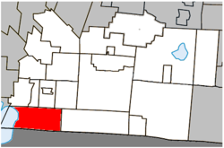
Saint-Armand, Quebec
| Saint-Armand | |
|---|---|
| Municipality | |
 |
|
 Location within Brome-Missisquoi RCM |
|
| Location in southern Quebec | |
| Coordinates: 45°02′N 73°03′W / 45.033°N 73.050°WCoordinates: 45°02′N 73°03′W / 45.033°N 73.050°W | |
| Country |
|
| Province |
|
| Region | Montérégie |
| RCM | Brome-Missisquoi |
| Constituted | February 3, 1999 |
| Government | |
| • Mayor | Réal Pelletier |
| • Federal riding | Brome—Missisquoi |
| • Prov. riding | Brome-Missisquoi |
| Area | |
| • Total | 84.00 km2 (32.43 sq mi) |
| • Land | 82.88 km2 (32.00 sq mi) |
| Population (2011) | |
| • Total | 1,248 |
| • Density | 15.1/km2 (39/sq mi) |
| • Pop 2006-2011 |
|
| • Dwellings | 671 |
| Time zone | EST (UTC−5) |
| • Summer (DST) | EDT (UTC−4) |
| Postal code(s) | J0J 1T0 |
| Area code(s) | 450 |
| Highways |
|
| Website | www |
Saint-Armand is a municipality in the Canadian province of Quebec, located within the Brome-Missisquoi Regional County Municipality and the Eastern Townships. The population as of the Canada 2011 Census was 1,248. It is located on the Canada–United States border
The Municipality of Saint-Armand and the Village of Philipsburg were amalgamated on February 3, 1999 to become the new Municipality of Saint-Armand.
Philipsburg, first known as Missiskoui Bay, was settled in 1784 and was reportedly the first settlement in the Eastern Townships.
Population trend:
(+) Amalgamation of the Municipality of Saint-Armand and the Village of Philipsburg on February 3, 1999.
Mother tongue language (2006)
...
Wikipedia

