Sai Ying Pun (MTR)
| MTR rapid transit station | ||||||||||||||||||||||||||||||||||||||||||||||||||||||||||||||||||||||||||||||

Platform 1
|
||||||||||||||||||||||||||||||||||||||||||||||||||||||||||||||||||||||||||||||
| Chinese name | ||||||||||||||||||||||||||||||||||||||||||||||||||||||||||||||||||||||||||||||
| Traditional Chinese | 西營盤 | |||||||||||||||||||||||||||||||||||||||||||||||||||||||||||||||||||||||||||||
| Simplified Chinese | 西营盘 | |||||||||||||||||||||||||||||||||||||||||||||||||||||||||||||||||||||||||||||
|
||||||||||||||||||||||||||||||||||||||||||||||||||||||||||||||||||||||||||||||
| General information | ||||||||||||||||||||||||||||||||||||||||||||||||||||||||||||||||||||||||||||||
| Location | Intersections between High Street, Centre Street, and Third Street, Sai Ying Pun Central and Western District, Hong Kong |
|||||||||||||||||||||||||||||||||||||||||||||||||||||||||||||||||||||||||||||
| Coordinates | 22°17′08″N 114°08′34″E / 22.2856°N 114.1427°ECoordinates: 22°17′08″N 114°08′34″E / 22.2856°N 114.1427°E | |||||||||||||||||||||||||||||||||||||||||||||||||||||||||||||||||||||||||||||
| Operated by | MTR Corporation | |||||||||||||||||||||||||||||||||||||||||||||||||||||||||||||||||||||||||||||
| Line(s) | ||||||||||||||||||||||||||||||||||||||||||||||||||||||||||||||||||||||||||||||
| Platforms | 2 (island platform) | |||||||||||||||||||||||||||||||||||||||||||||||||||||||||||||||||||||||||||||
| Connections | Bus, public light bus, tram | |||||||||||||||||||||||||||||||||||||||||||||||||||||||||||||||||||||||||||||
| Construction | ||||||||||||||||||||||||||||||||||||||||||||||||||||||||||||||||||||||||||||||
| Structure type | Underground | |||||||||||||||||||||||||||||||||||||||||||||||||||||||||||||||||||||||||||||
| Depth | 50 metres (160 ft) | |||||||||||||||||||||||||||||||||||||||||||||||||||||||||||||||||||||||||||||
| Platform levels | 1 | |||||||||||||||||||||||||||||||||||||||||||||||||||||||||||||||||||||||||||||
| Disabled access | Yes | |||||||||||||||||||||||||||||||||||||||||||||||||||||||||||||||||||||||||||||
| Other information | ||||||||||||||||||||||||||||||||||||||||||||||||||||||||||||||||||||||||||||||
| Station code | SYP | |||||||||||||||||||||||||||||||||||||||||||||||||||||||||||||||||||||||||||||
| History | ||||||||||||||||||||||||||||||||||||||||||||||||||||||||||||||||||||||||||||||
| Opened |
|
|||||||||||||||||||||||||||||||||||||||||||||||||||||||||||||||||||||||||||||
| Services | ||||||||||||||||||||||||||||||||||||||||||||||||||||||||||||||||||||||||||||||
|
||||||||||||||||||||||||||||||||||||||||||||||||||||||||||||||||||||||||||||||
|
||||||||||||||||||||||||||||||||||||||||||||||||||||||||||||||||||||||||||||||
| Location | ||||||||||||||||||||||||||||||||||||||||||||||||||||||||||||||||||||||||||||||
|
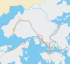
Location within the MTR system
|
||||||||||||||||||||||||||||||||||||||||||||||||||||||||||||||||||||||||||||||
| Transcriptions | |
|---|---|
| Standard Mandarin | |
| Hanyu Pinyin | Xīyíngpán |
| Yue: Cantonese | |
| Yale Romanization | sai1 ying4 pun4 |
| IPA | [sɐ́i jɪ̏ŋ pʰȕːn] |
| Jyutping | sai1 jing4 pun4 |
Sai Ying Pun (Chinese: 西營盤) is a station on the Hong Kong MTR Island Line. It serves the neighbourhood of Sai Ying Pun and the western part of Mid-Levels in northwestern Hong Kong Island, Hong Kong. Sai Ying Pun station opened on 29 March 2015, completing the West Island Line extension of the Island Line.
Sai Ying Pun serves as an intermediate station on the West Island Line, as opposed to a transfer station to another line serving the Southern District with the same name as in some previous plans.
Plans for the station first appeared in Hong Kong Mass Transit: Further Studies in 1970. It was to be built as part of the Island Line in the 1980s, but construction of the line did not commence westwards beyond Sheung Wan, due to inadequate forecast passenger numbers and technical difficulties identified by contractors.
In Outline Zoning Plan No. S/H3/20, the Planning Department of the government indicated one possible location under Des Voeux Road West at Ko Shing Street as of December 2003. A ventilation shaft marked with MTR notices can be found at the intersection. A large void facing Des Voeux Road West, sealed, can also be found at a nearby medical centre, which some have speculated that it was reserved for a to-be-built exit. These findings suggest that this was the original proposed location.
However, in proposals submitted to the government by the MTR in May 2002, the proposed station was shifted further west to the intersection of Des Voeux Road West and Water Street.
In March 2004, the MTR moved the station back east but south of the initial alignment under King George V Memorial Park. A source from MTR Corporation Limited (MTRCL) revealed to the local newspaper Ming Pao that this location was chosen to avoid any nuisance during works under major roads. The location would also better suit the needs of Mid-Levels residents, the source said.
...
Wikipedia

