Sai Wan Ho Station
| MTR rapid transit station | |||||||||||||

Platform 1
|
|||||||||||||
| Chinese name | |||||||||||||
| Traditional Chinese | 西灣河 | ||||||||||||
| Simplified Chinese | 西湾河 | ||||||||||||
| Literal meaning | Western bay river | ||||||||||||
|
|||||||||||||
| General information | |||||||||||||
| Location | Near Tai On Building, Shau Kei Wan Road, Sai Wan Ho Eastern District, Hong Kong |
||||||||||||
| Coordinates | 22°16′54″N 114°13′21″E / 22.2816°N 114.2224°ECoordinates: 22°16′54″N 114°13′21″E / 22.2816°N 114.2224°E | ||||||||||||
| Operated by | MTR Corporation | ||||||||||||
| Line(s) | |||||||||||||
| Platforms | 2 (split level side platforms) | ||||||||||||
| Connections | Bus, public light bus, tram, ferry | ||||||||||||
| Construction | |||||||||||||
| Structure type | Underground | ||||||||||||
| Platform levels | 2 | ||||||||||||
| Disabled access | Yes | ||||||||||||
| Other information | |||||||||||||
| Station code | SWH | ||||||||||||
| History | |||||||||||||
| Opened |
|
||||||||||||
| Services | |||||||||||||
|
|||||||||||||
| Location | |||||||||||||
|
Location within the MTR system
|
|||||||||||||
| Transcriptions | |
|---|---|
| Standard Mandarin | |
| Hanyu Pinyin | Xīwānhé |
| Yue: Cantonese | |
| Yale Romanization | sai1 waan1 ho2 |
| Jyutping | sai1 waan1 ho2 |
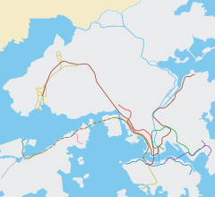
Sai Wan Ho (Chinese: 西灣河站) is a station in Sai Wan Ho on the Hong Kong MTR Island Line. It was opened on 31 May 1985. It is located under Shau Kei Wan Road in Sai Wan Ho in Eastern District.
The platforms of Sai Wan Ho station are constructed in a stacked arrangement, with platform 2 above platform 1.
Ferry services to Tung Lung Chau, Lei Yue Mun and Kwun Tong in Sai Wan Ho are provided at the pier along Tai On Street.
To reach the bus stop, cross the road by using the footbridge.
...
Wikipedia

