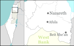
Saffuriya
|
Sepphoris צִפּוֹרִי |
|
|---|---|
 |
|
| Coordinates: 32°44′44″N 35°16′43″E / 32.74556°N 35.27861°ECoordinates: 32°44′44″N 35°16′43″E / 32.74556°N 35.27861°E | |
| District | Northern |
| Council | Jezreel Valley |
| Affiliation | Moshavim Movement |
| Founded | 5000 BCE (First settlement) 104 BCE (Hasmonean city) 634 (Saffuriya) 1949 (Israeli village) |
| Population (2016) | 963 |
| Saffuriyya | |
|---|---|
| Arabic | صفورية |
| Also spelled | Suffurriye, Safurriya |
| Subdistrict | Nazareth |
| Palestine grid | 176/239 |
| Population | 4,330 (1945) |
| Area | 55,378 dunams |
| Date of depopulation | 16 July 1948/January 1949 |
| Cause(s) of depopulation | Military assault by Yishuv forces |
| Secondary cause | Expulsion by Yishuv forces |
| Current localities | Zippori and the village land was distributed between Kibbutz Sde Nahum, Kibbutz Heftziba and Kibbutz HaSolelim |
Sepphoris /sɪˈfɔːrɪs/ or Zippori /ˈzɪpəraɪ/ (Hebrew: צִפּוֹרִי Tzipori; Ancient Greek: Σέπφωρις Sépphōris; Arabic: صفورية Saffuriya), also called Diocaesaraea (Ancient Greek: Διοκαισάρεια) and, during the Crusades, Sephory/ˈsɛfəri/ (Old French: La Sephorie), is a village and an archeological site located in the central Galilee region of Israel, 6 kilometers (3.7 mi) north-northwest of Nazareth. It lies 286 m above sea level and overlooks the Beit Netofa Valley. The site holds a rich and diverse historical and architectural legacy that includes Hellenistic, Jewish, Roman, Byzantine, Islamic, Crusader, Arabic and Ottoman influences.
...
Wikipedia

