Ruggles Township, Ashland County, Ohio
| Ruggles Township, Ashland County, Ohio | |
|---|---|
| Township | |

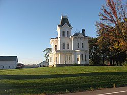
The Crittenden Farmhouse, a historic site in the township
|
|
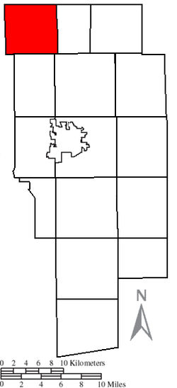
 Location of Ruggles Township in Ashland County |
|
| Coordinates: 41°2′23″N 82°23′2″W / 41.03972°N 82.38389°WCoordinates: 41°2′23″N 82°23′2″W / 41.03972°N 82.38389°W | |
| Country | United States |
| State | Ohio |
| County | Ashland |
| Area | |
| • Total | 26.0 sq mi (67.4 km2) |
| • Land | 25.8 sq mi (66.9 km2) |
| • Water | 0.2 sq mi (0.5 km2) |
| Elevation | 1,086 ft (331 m) |
| Population (2010) | |
| • Total | 905 |
| • Density | 35/sq mi (13.5/km2) |
| Time zone | Eastern (EST) (UTC-5) |
| • Summer (DST) | EDT (UTC-4) |
| FIPS code | 39-68966 |
| GNIS feature ID | 1085714 |
Ruggles Township is one of the fifteen townships of Ashland County, Ohio, United States. As of the 2010 census the population was 905.
Located in the northwestern corner of the county, it borders the following townships:
No municipalities are located in Ruggles Township.
It is the only Ruggles Township statewide.
This township is included in the region known as the Firelands and was originally a part of adjacent Huron County. It is named for Almon Ruggles, a surveyor retained by the Connecticut Land Company in 1808 and the first county recorder of Huron County.
Huron County was established by the Ohio General Assembly on February 7, 1809, and at the time comprised present-day Erie County (except a small part in the northwest), Huron County, Ruggles Township in Ashland County, Danbury Township in Ottawa County, and part of Catawba Island Township in Ottawa County - in short, the entire Firelands.
Ruggles Township was added to Ashland County when it was formed on February 24, 1846 from portions of Huron, Lorain, Richland, and Wayne counties.
Ruggles Township is home to Crittenden Farmhouse, a historic farmstead listed on the National Register of Historic Places.
...
Wikipedia
