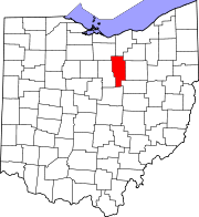
Ashland County, Ohio
| Ashland County, Ohio | ||
|---|---|---|

Ashland County Courthouse
|
||
|
||
 Location in the U.S. state of Ohio |
||
 Ohio's location in the U.S. |
||
| Founded | February 24, 1846 | |
| Named for | "Ashland", Henry Clay's home | |
| Seat | Ashland | |
| Largest city | Ashland | |
| Area | ||
| • Total | 427 sq mi (1,106 km2) | |
| • Land | 423 sq mi (1,096 km2) | |
| • Water | 3.8 sq mi (10 km2), 0.9% | |
| Population | ||
| • (2010) | 53,139 | |
| • Density | 126/sq mi (49/km²) | |
| Congressional district | 7th | |
| Time zone | Eastern: UTC-5/-4 | |
| Website | www |
|
Ashland County is a county in the U.S. state of Ohio. As of the 2010 census, the population was 53,139. Its county seat is Ashland. The county is named for "Ashland", the home of Senator Henry Clay near Lexington, Kentucky. It was formed in 1846 from parts of Huron, Lorain, Richland and Wayne Counties.
Ashland County comprises the Ashland, OH Metropolitan Statistical Area, which is also included in the Mansfield-Ashland-Bucyrus, OH Combined Statistical Area.
Ashland County was formed on February 24, 1846 from portions of Huron, Lorain, Richland, and Wayne counties. Like the county seat, it was named after Ashland, the Lexington, Kentucky-area home of Henry Clay, a Kentucky senator.
According to the U.S. Census Bureau, the county has a total area of 427 square miles (1,110 km2), of which 423 square miles (1,100 km2) is land and 3.8 square miles (9.8 km2) (0.9%) is water.
...
Wikipedia

