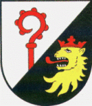
Roth, Bad Kreuznach
| Roth | ||
|---|---|---|
|
||
| Coordinates: 49°56′40″N 7°48′06″E / 49.94444°N 7.80167°ECoordinates: 49°56′40″N 7°48′06″E / 49.94444°N 7.80167°E | ||
| Country | Germany | |
| State | Rhineland-Palatinate | |
| District | Bad Kreuznach | |
| Municipal assoc. | Stromberg | |
| Government | ||
| • Mayor | Helmut Höning | |
| Area | ||
| • Total | 0.82 km2 (0.32 sq mi) | |
| Elevation | 300 m (1,000 ft) | |
| Population (2015-12-31) | ||
| • Total | 271 | |
| • Density | 330/km2 (860/sq mi) | |
| Time zone | CET/CEST (UTC+1/+2) | |
| Postal codes | 55442 | |
| Dialling codes | 06724 | |
| Vehicle registration | KH | |
| Website | www.roth-bingen.de | |
Roth is an Ortsgemeinde – a municipality belonging to a Verbandsgemeinde, a kind of collective municipality – in the Bad Kreuznach district in Rhineland-Palatinate, Germany. It belongs to the Verbandsgemeinde of Stromberg, whose seat is in the like-named town.
Roth lies southwest of the Rhine in the Hunsrück. It sits at an elevation of some 350 m above sea level on a small mountain ridge. The municipal area measures 84 ha.
Clockwise from the north, Roth’s neighbours are the municipalities of Warmsroth, Waldalgesheim and Waldlaubersheim and the town of Stromberg, all of which likewise lie within the Bad Kreuznach district but for Waldalgesheim, which lies in the neighbouring Mainz-Bingen district.
In 1987, Roth celebrated its 800th anniversary, the grounds for doing so being the oldest known document that contains the village’s name, one from Rupertsberg Abbey near Bingen from the year 1187. According to this parchment, now kept at the Koblenz State Archive, Archbishop of Mainz Conrad I freed the monastery and its holdings from episcopal taxation and put them under his protection. It seems certain that the “Roth” to which the document refers is indeed the subject of this article (“Roth” is otherwise a very common placename). Even if the document was not sealed, that is to say, never gained the force of law, the presence of that name in its text is still proof that the village existed that long ago. The name also says something about the village’s beginnings. It literally means a clearing. What is unusual, though, is that the name does not have a prefix identifying its founder, owner, or leader as most others do, as seen, for instance, in Duchroth, Eckenroth, Gebroth, Kirschroth and Warmsroth, to name only the examples in this district (the last one, for instance, likely indicates a clearing owned by the city of Worms). According to the Germanist Adolf Bach (1890-1972), placenames ending in —rod (a more commonly occurring form) arose in the time from the 10th century to the 14th, and especially in the 12th and 13th, as clearings in woodland areas with more than 150 frost days each year, making their locations rather less favourable than places that had arisen in the treeless areas of the original landscape. It can thus be concluded that Roth likely arose not too long before this 1187 first documentary mention. Roth was originally laid out in the “original municipal area” of Waldlaubersheim. The Viergemeindewald (“Four-Municipality Forest”) on which lie not only Roth but also Waldlaubersheim, Genheim (now a constituent community of Waldalgesheim), Warmsroth and Wald-Erbach, bears witness to the village’s membership in this greater municipal area after 1589. In his Urkundliche Geschichte (“Documentary History”), Father Wagner cites from Rupertsberg Abbey’s general directory of holdings (1200-1270) that Roth had to pay the abbey 11 Unzen and 6 Denare in rent on Martinmas (11 November), a contribution that may well hint at the holding’s small significance. The jurisdiction by Schöffen (roughly “lay jurists”) in Roth in those days was exercised by Hermanus von Genheim for Rodenkirchen (or Rothenkirchen) Abbey near Kirchheimbolanden. For the income that was bound with this, he and his wife Adelheid had to pay 20 Denare in interest. As a document filled out in Mainz has it, the knight Sir Heinrich of Glymendail and his wife Christina – who seemingly held a great many landholds in Roth – donated “produce benefits at Rod (Roth)” to Rupertsberg Abbey in 1283 to keep their memory alive with yearly Masses on the anniversaries of their deaths, and also donated further holdings near the village of Rod against a yearly annuity of 20 Malter of corn (likely either wheat or rye). Besides Rupertsberg Abbey, a lord from Brandenburg (now in Luxembourg) must also have owned an estate in Roth until 1417. In 1589, ten households were counted in Roth. The tithes were split between the Junker of Schönburg (Oberwesel), who got a two-thirds share, and the chaplain at Stromberg, who got the remaining third. Before the Reformation, the chaplain’s third belonged to Rodenkirchen Abbey, and Roth itself belonged to the parish of Waldlaubersheim. Administratively, Roth, along with Genheim, which through its amalgamation with Waldalgesheim was removed from this historical tie, and Eckenroth belonged quite early on to the Stromburg (the castle above the town of Stromberg), which itself was under royal or Imperial ownership until 1156. In that year, Roth, along with the Stromburg, passed into the Counts Palatine’s hands. It is thus understandable that even by 1410, the town of Bingen was offering the Roth villagers shelter within its walls in times when they were under attack. For this service, they had to contribute towards maintaining the fortifications and for the town’s actual defence. While the number of households in Roth in 1589 had been, as mentioned above, ten, by 1789 – the year when the French Revolution broke out – it had only grown to 14.
...
Wikipedia


