Rossville, Illinois
| Rossville | |
|---|---|
| Village (United States) | |

Welcome sign at the north edge of town, 2007
|
|
 Vermilion County's location in Illinois |
|
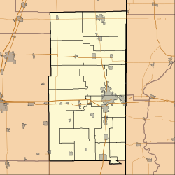
| Rossville's location in Vermilion County | |
| Coordinates: 40°22′45″N 87°40′07″W / 40.37917°N 87.66861°WCoordinates: 40°22′45″N 87°40′07″W / 40.37917°N 87.66861°W | |
| Country |
|
| State |
|
| County | Vermilion |
| Township | Grant, Ross |
| Post office established | 1839 |
| Founded | 1862 |
| Area | |
| • Total | 3.6 km2 (1.40 sq mi) |
| • Land | 3.6 km2 (1.40 sq mi) |
| • Water | 0.0 km2 (0.00 sq mi) |
| Elevation | 209 m (686 ft) |
| Population (2010) | |
| • Total | 1,331 |
| • Density | 370/km2 (950/sq mi) |
| ZIP code | 60963 |
| Area code(s) | 217 |
| GNIS feature ID | 0424549 |
| Website | Village Website |
Rossville is a village in Ross Township, Vermilion County, Illinois, United States. As of the 2010 census, the city population was 1,331. It is part of the Danville, Illinois Metropolitan Statistical Area.
The location was originally named Liggett's Grove in honor of John Liggett who built a lodging house in 1829. Liggett's cabin was located on the Hubbard Trail, an early trading route established by Gurdon Hubbard from Chicago to Danville. In 1833, this became the first state highway (now Illinois Route 1) and in 1914 was made part of the Dixie Highway.
In 1838, Alvan Gilbert purchased the Liggett farm, and the following year became postmaster at the newly established post office. Rossville was incorporated as a village in August 1859. Rossville and Ross Township were named after Jacob Ross, a settler in the area.
In February 2004, a fire broke out in the downtown business district and destroyed several of the historic buildings and antique shops for which Rossville has been known.
Rossville's coordinates are 40°22′50″N 87°40′7″W / 40.38056°N 87.66861°W (40.380424, -87.668557). According to the 2010 census, Rossville has a total area of 1.4 square miles (3.63 km2), all land.
As of the census of 2000, there were 1,217 people, 533 households, and 341 families residing in the village. The population density was 905.1 people per square mile (350.7/km²). There were 596 housing units at an average density of 443.2 per square mile (171.7/km²). The racial makeup of the village was 97.78% White, 0.25% African American, 0.16% Native American, 0.08% Asian, 0.90% from other races, and 0.82% from two or more races. Hispanic or Latino of any race were 2.14% of the population.
...
Wikipedia

