Roquefort-la-Bédoule
| Roquefort-la-Bédoule | ||
|---|---|---|
| Commune | ||

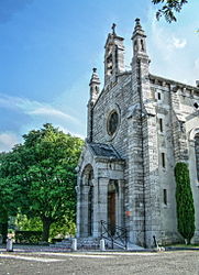
St. Roseline
|
||
|
||
| Coordinates: 43°14′54″N 5°35′29″E / 43.2483°N 5.5914°ECoordinates: 43°14′54″N 5°35′29″E / 43.2483°N 5.5914°E | ||
| Country | France | |
| Region | Provence-Alpes-Côte d'Azur | |
| Department | Bouches-du-Rhône | |
| Arrondissement | Marseille | |
| Canton | La Ciotat | |
| Intercommunality | Marseille Provence Métropole | |
| Government | ||
| • Mayor (2008–2014) | Jérôme Orgeas | |
| Area1 | 31.15 km2 (12.03 sq mi) | |
| Population (2008)2 | 5,038 | |
| • Density | 160/km2 (420/sq mi) | |
| Time zone | CET (UTC+1) | |
| • Summer (DST) | CEST (UTC+2) | |
| INSEE/Postal code | 13085 /13830 | |
| Dialling codes | 0491 | |
| Elevation | 158–567 m (518–1,860 ft) (avg. 276 m or 906 ft) |
|
|
1 French Land Register data, which excludes lakes, ponds, glaciers > 1 km² (0.386 sq mi or 247 acres) and river estuaries. 2Population without double counting: residents of multiple communes (e.g., students and military personnel) only counted once. |
||
1 French Land Register data, which excludes lakes, ponds, glaciers > 1 km² (0.386 sq mi or 247 acres) and river estuaries.
Roquefort-la-Bédoule is a commune in the department of Bouches-du-Rhône in the Provence-Alpes-Côte d'Azur region in southern France. Its inhabitants are called Bédoulens.
It is situated north of Cassis, Ceyreste and La Cadière-d'Azur, but south of Aubagne, Gémenos and Cuges-les-Pins and east of Carnoux-en-Provence and west of Castellet.
It was founded during the 7th century.
...
Wikipedia


