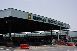
Rocklea, Queensland
|
Rocklea Brisbane, Queensland |
|||||||||||||
|---|---|---|---|---|---|---|---|---|---|---|---|---|---|

The Brisbane Markets within the suburb
|
|||||||||||||
| Population | 1,255 (2011 census) | ||||||||||||
| • Density | 137.9/km2 (357.2/sq mi) | ||||||||||||
| Postcode(s) | 4106 | ||||||||||||
| Area | 9.1 km2 (3.5 sq mi) | ||||||||||||
| Location | 9 km (6 mi) from Brisbane | ||||||||||||
| LGA(s) |
City of Brisbane (Moorooka Ward) |
||||||||||||
| State electorate(s) | Yeerongpilly | ||||||||||||
| Federal Division(s) | Moreton | ||||||||||||
|
|||||||||||||
Rocklea is a large suburb of Brisbane, the state capital of Queensland, Australia. The suburb is located 9 kilometres south of the city. At times the suburb has experienced significant flooding from the nearby Brisbane River. The west of the suburb is bordered by the Oxley Creek. Its tributaries, Stable Swamp Creek and Rocky Waterholes Creek, are the cause of local flooding. The suburb's name is derived from the Rocky Waterholes in the area.
It is also at one end of the Ipswich Motorway and has a train station on the Beenleigh line. Ipswich Road continues north from the Ipswich Motorway, through Moorooka and into the Brisbane central business district.
Rocklea is a mostly industrial suburb, being the home to many large firms from a range industries. The suburb has a school, Rocklea State School, which was opened in 1885. At the 2011 Australian Census Rocklea had a population of 1,255.
The locality was originally called Rocky Water Holes. It was renamed Rocklea with the opening of the railway. In January 1925 work commenced on the Sydney–Brisbane rail corridor.
The suburbs was once the centre of the Shire of Yeerongpilly which was established in 1879 and disbanded in 1925 after the City of Brisbane was created. In 1949, Commonwealth Engineering established a railway factory in Rocklea. On 31 July 2009 the last race was held at the Rocklea horse harness racing track.
...
Wikipedia
