Rockaway, New Jersey
| Rockaway, New Jersey | |
|---|---|
| Borough | |
| Borough of Rockaway | |
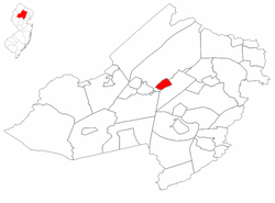
 Rockaway highlighted in Morris County. Inset map: Morris County highlighted in the State of New Jersey. |
|
 Census Bureau map of Rockaway, New Jersey |
|
| Coordinates: 40°53′45″N 74°31′03″W / 40.895786°N 74.517431°WCoordinates: 40°53′45″N 74°31′03″W / 40.895786°N 74.517431°W | |
| Country |
|
| State |
|
| County | Morris |
| Incorporated | June 19, 1894 |
| Government | |
| • Type | Borough |
| • Body | Borough Council |
| • Mayor | Russell Greuter (R, term ends December 31, 2019) |
| • Clerk | Sheila Seifert |
| Area | |
| • Total | 2.119 sq mi (5.488 km2) |
| • Land | 2.072 sq mi (5.367 km2) |
| • Water | 0.047 sq mi (0.121 km2) 2.20% |
| Area rank | 400th of 566 in state 34th of 39 in county |
| Elevation | 538 ft (164 m) |
| Population (2010 Census) | |
| • Total | 6,438 |
| • Estimate (2015) | 6,494 |
| • Rank | 332nd of 566 in state 27th of 39 in county |
| • Density | 3,106.7/sq mi (1,199.5/km2) |
| • Density rank | 209th of 566 in state 9th of 39 in county |
| Time zone | Eastern (EST) (UTC-5) |
| • Summer (DST) | Eastern (EDT) (UTC-4) |
| ZIP code | 07866 |
| Area code(s) | 973 |
| FIPS code | 3402764050 |
| GNIS feature ID | 0885374 |
| Website | www |
Rockaway is a borough in Morris County, New Jersey, United States. As of the 2010 United States Census, the borough's population was 6,438, reflecting a decline of 35 (-0.5%) from the 6,473 counted in the 2000 Census, which had in turn increased by 230 (+3.7%) from the 6,243 counted in the 1990 Census.
Rockaway was formed as a borough on June 19, 1894, from portions of Rockaway Township, based on the results of a referendum held the previous day. Additional portions of Rockaway Township were annexed by the borough in 1908.
The borough shares its name with the Rockaway River and the neighboring township. The name is derived from a Native American term, variously said to mean "place of sands", "creek between two hills" or "bushy" / "difficult to cross".
According to the United States Census Bureau, the borough had a total area of 2.119 square miles (5.488 km2), including 2.072 square miles (5.367 km2) of land and 0.047 square miles (0.121 km2) of water (2.20%).
The climate in this area is characterized by hot, humid summers and generally mild to cool winters. According to the Köppen Climate Classification system, Rockaway has a humid subtropical climate, abbreviated "Cfa" on climate maps.
The 2010 United States Census counted 6,438 people, 2,443 households, and 1,656 families residing in the borough. The population density was 3,106.7 per square mile (1,199.5/km2). The borough contained 2,521 housing units at an average density of 1,216.5 per square mile (469.7/km2). The racial makeup of the borough was 82.79% (5,330) White, 3.22% (207) Black or African American, 0.14% (9) Native American, 7.66% (493) Asian, 0.06% (4) Pacific Islander, 4.05% (261) from other races, and 2.08% (134) from two or more races. Hispanics or Latinos of any race were 15.07% (970) of the population.
...
Wikipedia
