Rochester Airport, England
| Rochester Airport | |||||||||||||||||||
|---|---|---|---|---|---|---|---|---|---|---|---|---|---|---|---|---|---|---|---|
| Summary | |||||||||||||||||||
| Airport type | Private | ||||||||||||||||||
| Operator | Rochester Airport Ltd. | ||||||||||||||||||
| Location | Rochester, Medway | ||||||||||||||||||
| Elevation AMSL | 426 ft / 130 m | ||||||||||||||||||
| Coordinates | 51°21′07″N 000°30′10″E / 51.35194°N 0.50278°ECoordinates: 51°21′07″N 000°30′10″E / 51.35194°N 0.50278°E | ||||||||||||||||||
| Website | www.rochesterairport.co.uk | ||||||||||||||||||
| Map | |||||||||||||||||||
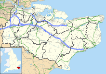
| Location in Kent | |||||||||||||||||||
| Runways | |||||||||||||||||||
|
|||||||||||||||||||
Rochester Airport (IATA: RCS, ICAO: EGTO) is an operational general aviation aerodrome located 1.5 nautical miles (2.8 km; 1.7 mi) south of Rochester, Medway, South East England, with the River Medway 1.5 NM (2.8 km; 1.7 mi) from the end of runway 34, 3.4 mi (5.5 km) from Chatham and its Historic Dockyard and the Medway area.
Rochester Aerodrome has a CAA Ordinary Licence (Number P846) that allows flights for the public transport of passengers or for flying instruction as authorised by the licensee (Rochester Airport PLC).
Rochester City Council compulsory purchased the land at Rochester Airfield in September 1933 from the landowner as the site for a municipal airport. One month later Short Brothers, who had started building aircraft in 1909 on the Isle of Sheppey, asked for permission to lease the land for test flying and thus began the privileged relationship between the local authority and the aviation industry.
The inaugural flight into Rochester was from Gravesend, with John Parker flying their Short Scion, G-ACJI, powered by a Pobjoy engine. Civilian services started with flights from Rochester to Southend Airport in June 1934 at a cost of 12 shillings (60p) for the return trip.
...
Wikipedia

